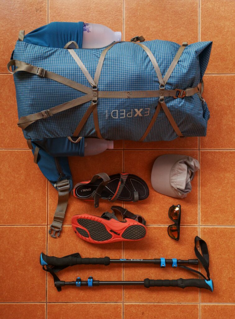
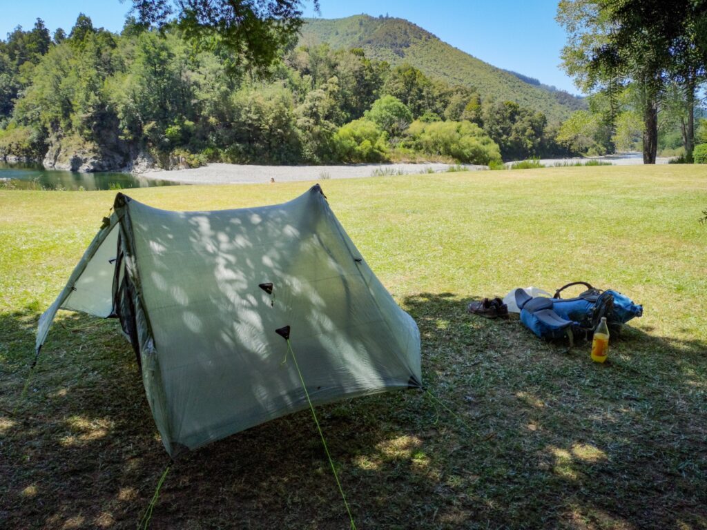
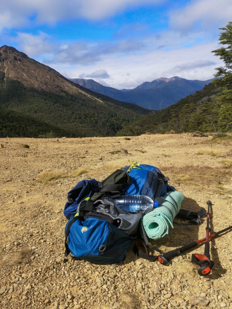
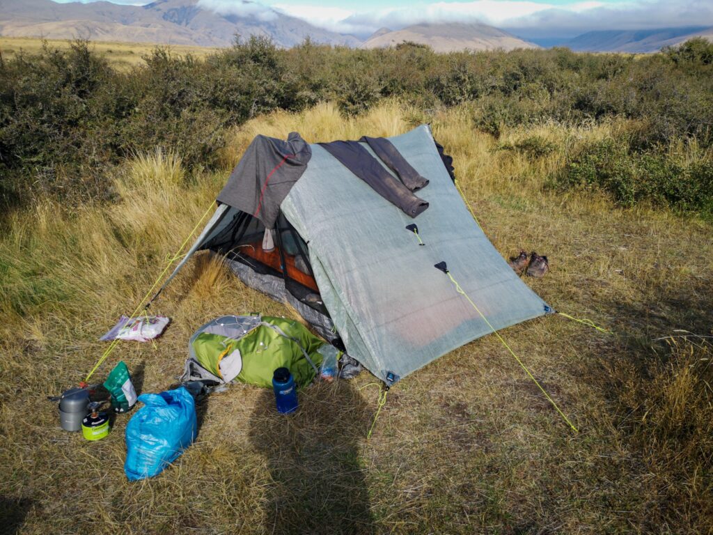
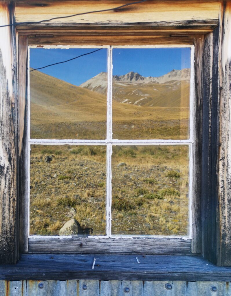
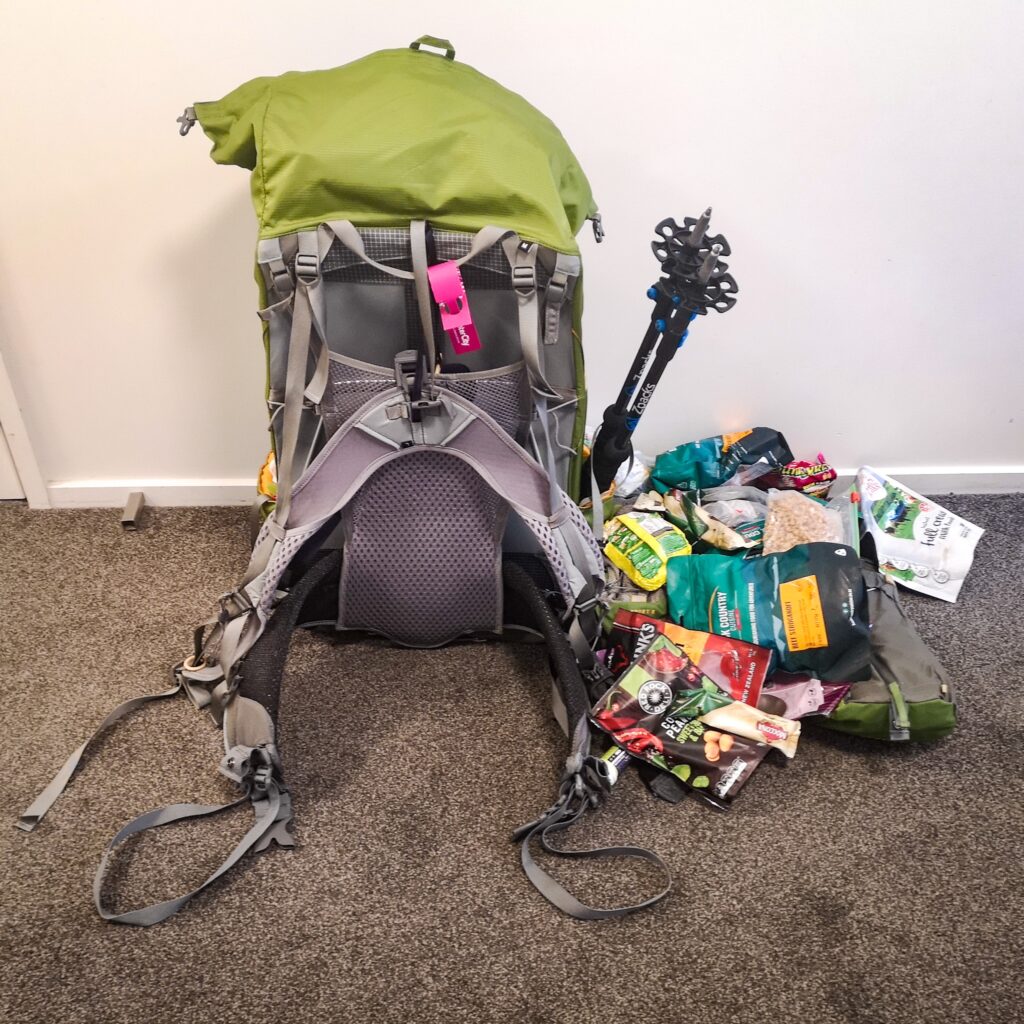
2020 Pack list (2020-01-18 05:46)
The first 6 months of 2020 are going to be “on the road” and I have had to think a bit about what to pack along with me as I will be doing a few different things, each requiring slightly different equipment.
The list of stuff below is the result. This list is very different from what I would pack if I were only to backpack through Asia (I would carry nowhere near as much stuff), or if I were only going to hike the Te Araroa. It is a compromise and I am carrying a little bit too much for each individual section in order to be able to do everything without having to resupply.
I’m also starting out with a few too many clothes, and a pair of footwear too much as I know I will wear out some stuff. As I already own extras, I’m being too cheap to buy new stuff along the road as it wears out, and carrying some extra weight instead.
🙂
Starting out with the big 3:
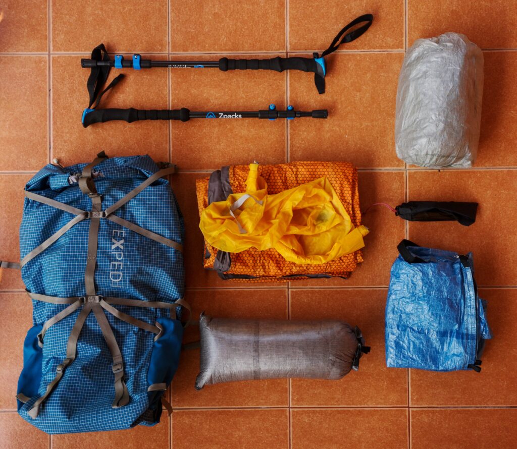
- Exped Lightning 45l backpack
- Zpacks Duplex tent with 8 tent pegs
- Zpacks carbon fiber hiking poles
- Exped Synmat UL LW sleeping pad, with pump sack
- Thermarest Vesper -6 quilt
- Zpacks airplane case, doubles as waterproof pack liner
Then clothes:
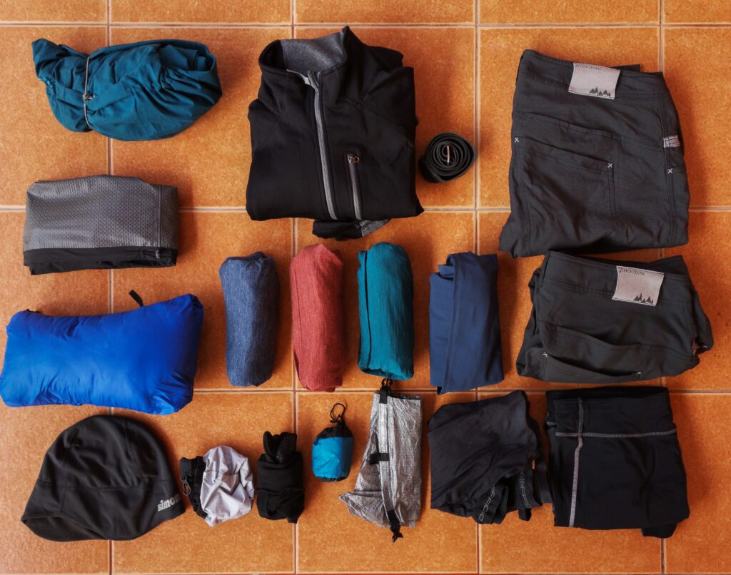
- Houdini rain jacket
- Haglöfs L.I.M. rain pants
- Forclaz down jacket with hood
- Beanie, fleece
- Houdini fleece jumper
- 3 wool t-shirts
- Houdini Liquid long sleeve t-shirt
- Zpacks Vertice over mitts
- Icebreaker thin wool gloves
- Sea to Summit bug head net
- Zpacks stuff sack
- 3 pair Exofficio briefs
- Houdini long pants
- Houdini shorts
- Nike running shorts (not in the photo, I was wearing them)
- Houdini Liquid tights
Then the important footwear:
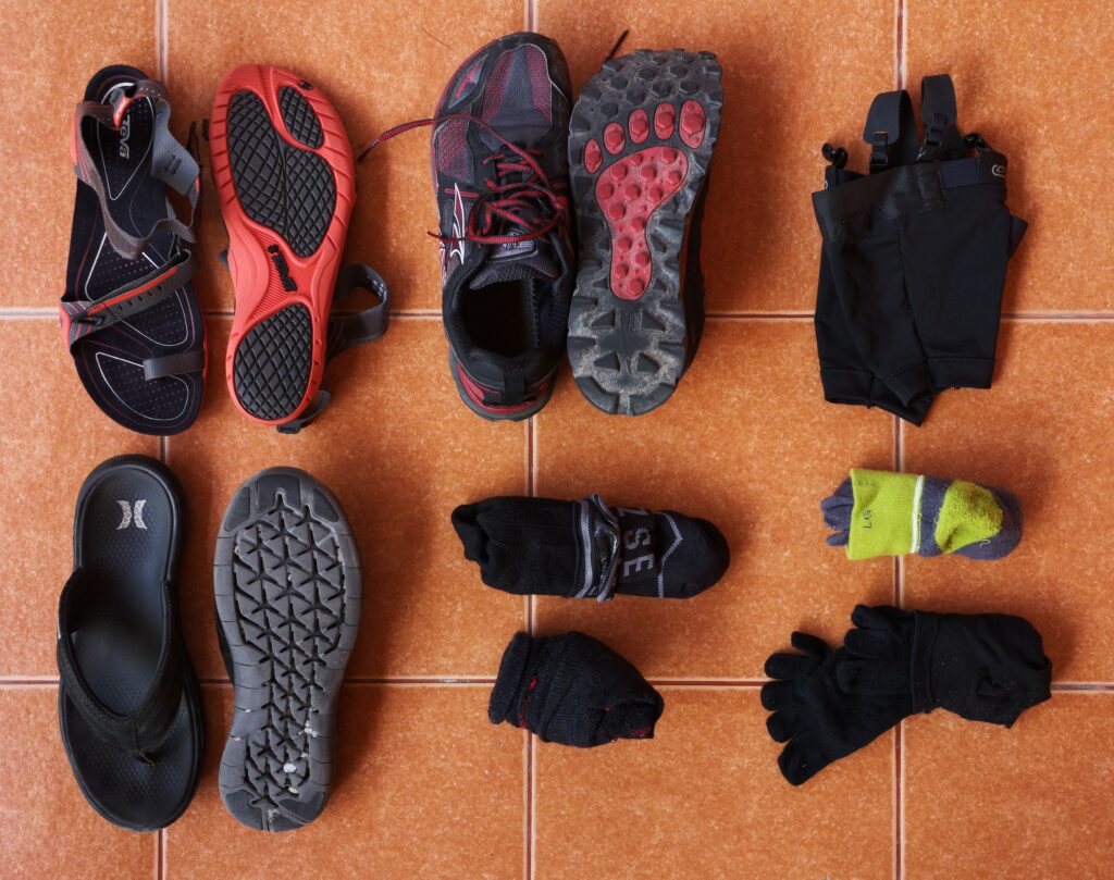
- Teva sandals
- Hurley flip-flops
- Altra Lone Peak shoes
- Sealskinz waterproof socks
- Icebreaker wool socks
- 2 pair Injinji toe-socks
- Lightweight ankle gaiters
And the rest:
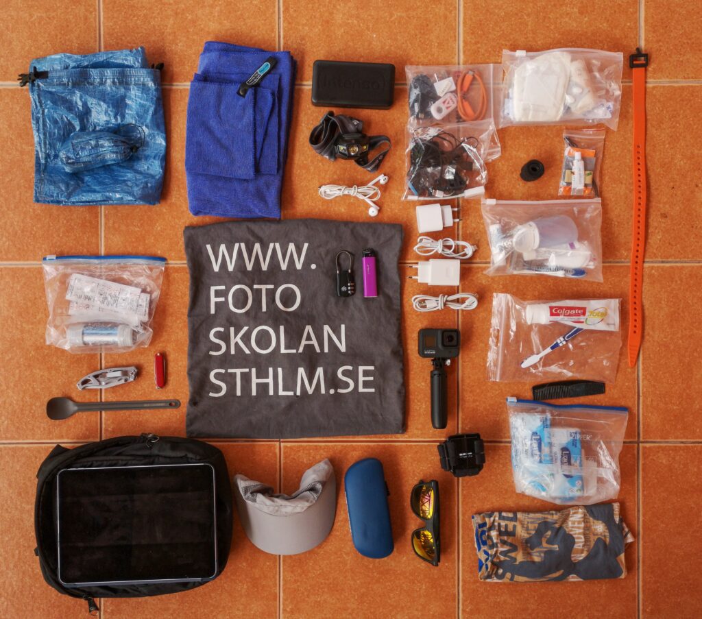
- Zpacks food bag with bear hanging kit
- Water filter and purifying tablets
- Gerber titanium folding knife
- Small Swiss Army knife with scissors
- Sea to summit titanium spoon
- Pack-safe small shoulder bag
- iPad Pro 11”
- Small travel towel
- 20,000 milliamperes power bank
- Headlamp
- Headphones
- Small combination lock
- Lighter
- Carry bag (Fotoskolan)
- Running cap
- Reading glasses with hard case
- Sunglasses
- Electronics (cables, extra memory cards, adaptors etc)
- 2 chargers with cables
- GoPro with shorty stand
- GoPro head mount
- First aid kit
- Repair kit
- Toiletries
- Toilet paper and tissues
- Buff
- Huawei P20 Pro mobile phone (not in photo, taking it)
That’s it.
It weighs in at just under 11 kilos, about 2 kilos more than I would like. But it will get lighter as I wear stuff out.
🙂
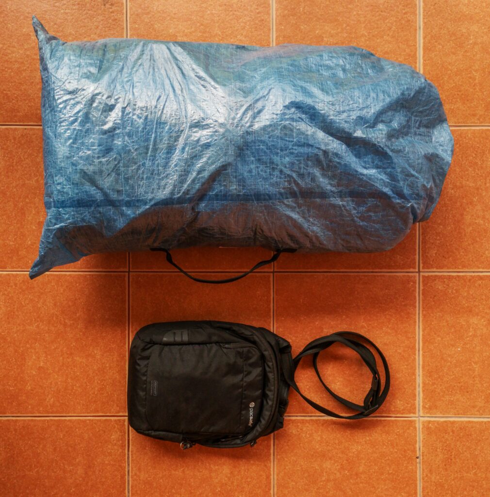
It packs up like this for hiking:
And like this for aeroplane travel:
This kit should allow me to hike and camp comfortably down to about 0 degrees, a complete 3 season set-up. It will be interesting to see how it all works and what changes I make during the coming months because as you all know, change is second nature to me!
🙂
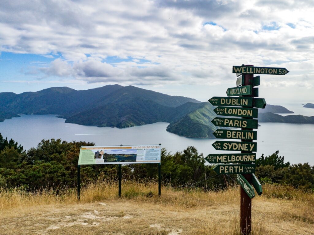
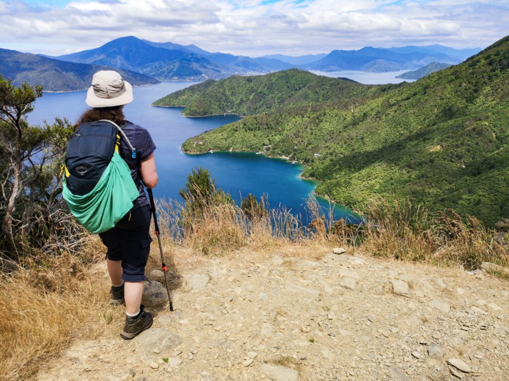
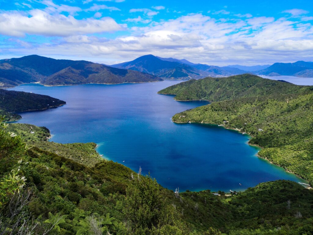
Queen Charlotte Track (2020-02-09 08:47)
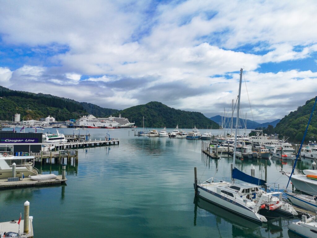
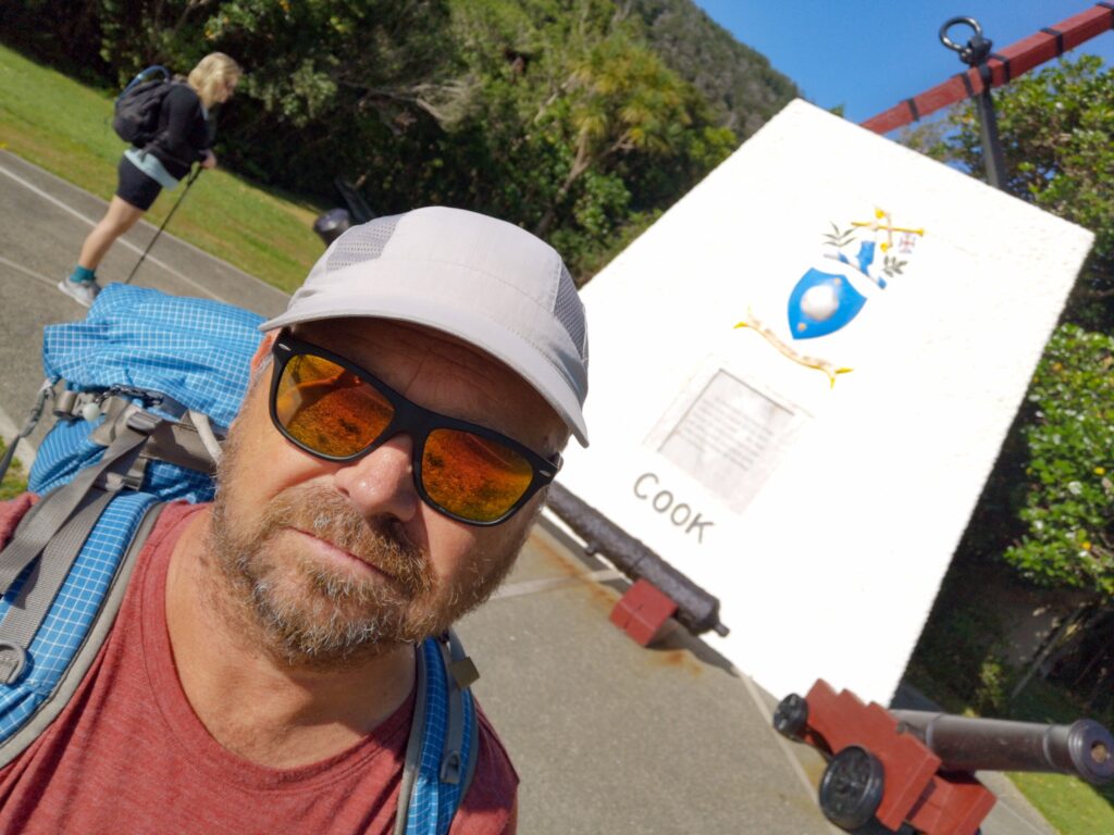
After too many rides on planes and busses, too much waiting to get to the start, it was finally time to take the last boat ride out to the start of the Queen Charlotte track. There had been a bit of rain during my two nights in Picton, but Thursday looked to become totally brilliant,
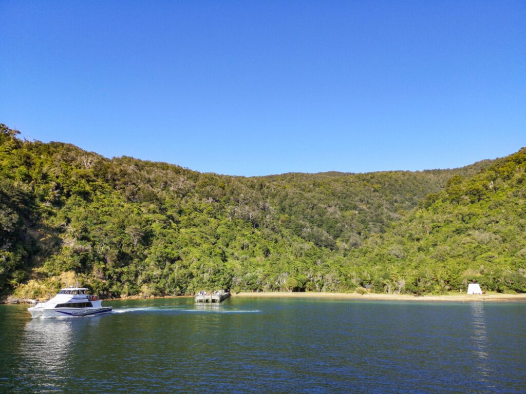
I took the early boat out to Ship Cove, at 8 am. There were some other hikers on board and everyone was looking happy and expectant.
From Ship Cove, the walk was up over the saddle and down to Schoolhouse Bay. It was a nice, well-maintained track and even though there was a bit of climbing, it was nice easy walking. A perfect start to get your legs and lungs working.
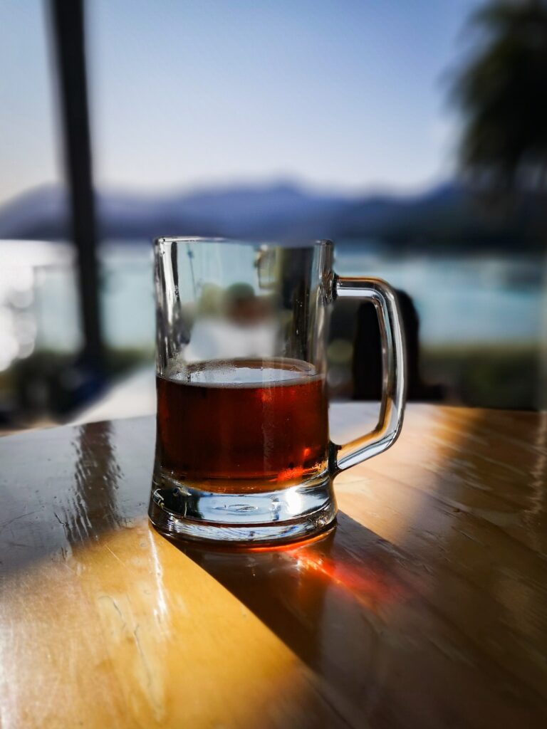
I continued on towards Furneaux Lodge where I had an unexpected lunch. There was a nice restaurant and rather than making a peanut butter and banana wrap, I had a large cider and a hamburger. This was the first of many times that I found great food along the trail that I wasn’t expecting. In fact, I carried a lot of unnecessary food during my walk. Had I known how much food I would be able to buy along the way, I would have carried a lot less.
After lunch and a bit of a rest, I continued on through great scenery to Camp Bay campsite. Day one was 29 km and felt surprisingly easy. I was sure I would feel it the next day and I felt hotspots developing on the bottom of my soles and had already decided to walk in shoes the next day.
There were a lot of people at the campsite, from all over the world but a lot of New Zealanders, as it turned out, it was the start of a long weekend. A lot of them had had their packs transported by boat to the campsite and had walked with just their day packs, and would have their packs transported to the next campsite the next day. It turned out that it was a service that the boat company offered at no extra cost if you bought a return trip, that is a ride out to Ship Cove and a return from Anakiwa. For anyone walking just the QC, it would be a great way to do it.
It was interesting to watch and talk to the many different sorts of hikers at the campsite. Some obvious beginners who had trouble setting up their tents and lighting their stoves, some Europeans with great big 20 to 30-kilo packs, and some more experienced hikers with lighter and more organized kits.
The next day I got up early but took it easy before heading off up the steep hill that was the start of day two. This day would be shorter but everyone was expecting it to be harder, with much more climbing and descending.
About half an hour into the hike, I caught up to a kiwi girl I had spoken to the night before and we walked the rest of the day together. It wasn’t planned, our pace just matched and she was good company, she didn’t talk much at all and we could both just enjoy the views.
It was a harder day, partly because the track went up and down more, but also because we had yesterday’s hike in our legs.
The day finished after 24 km at Cowshed Bay campsite and after setting up the tent, I walked over to Portage to get a pizza and a cold beer. Ok, maybe two beers…
I got an early start again the next day and headed up over the hill at a good pace. I was back in flip-flops and feeling surprisingly good. It took me just a bit more than two hours to do the first section to Te Mahia Bay, a section that is listed as a four-hour walk. I rewarded myself with a brunch at the Te Mahia resort as I hadn’t had any breakfast and was looking forward to a large cup of coffee.
It was very easy to polish off a portion of fish and chips!
Then there was only the last section towards Anakiwa to walk. Like the rest of the track, it was beautiful, with great scenery but it was also a lot more crowded. I met more hikers and a lot more mountain bikers than any of the other days. It’s not that it was crowded, but nowhere as empty as the days before. It could have been because it was a long weekend and that the weather was great. I couldn’t really have asked for better weather than I had for the three days on the track.
Would I recommend the QC track?
Yeah, without hesitation! It was a great walk and would be well worth it even if you wanted to do “only” the QC. I would probably have done it over a longer time if I wasn’t continuing on along the Te Araroa. There are lots of interesting sights to see along the way and plenty of campsites, if a little bit expensive.
As I write this, I am in Havelock and have just bought food for nine days hiking along the TA. It’s the last chance to resupply for a while and I hope I have bought enough!
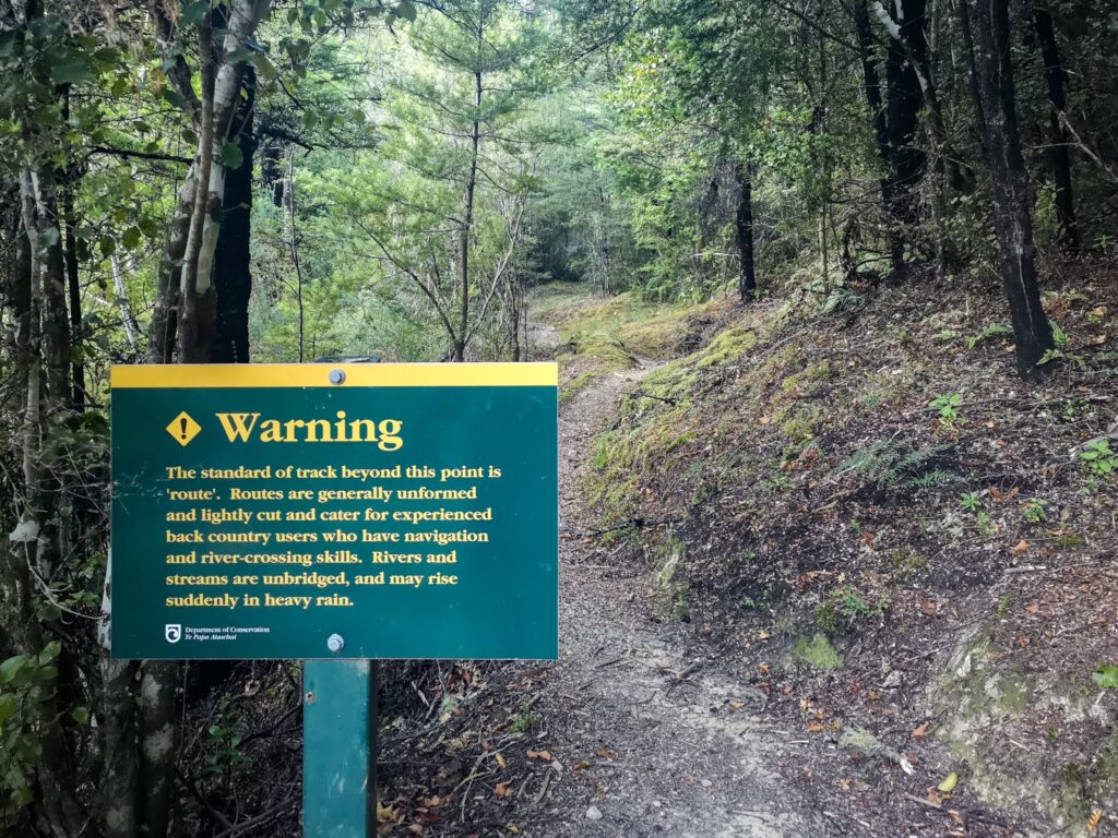
There is also a question about what the trail is going to be like further south. Two hikers have been killed during the weekend trying to cross rivers swollen by rain and some trails have even been closed. It should not affect me for a couple of weeks, but I will have to see what the situation is like when I get further south.
But to start with, I have to try to get through the next 9 to 10 days. It should be interesting to see what it’s like to finally get out in the wilderness here in NZ!
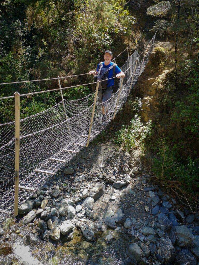
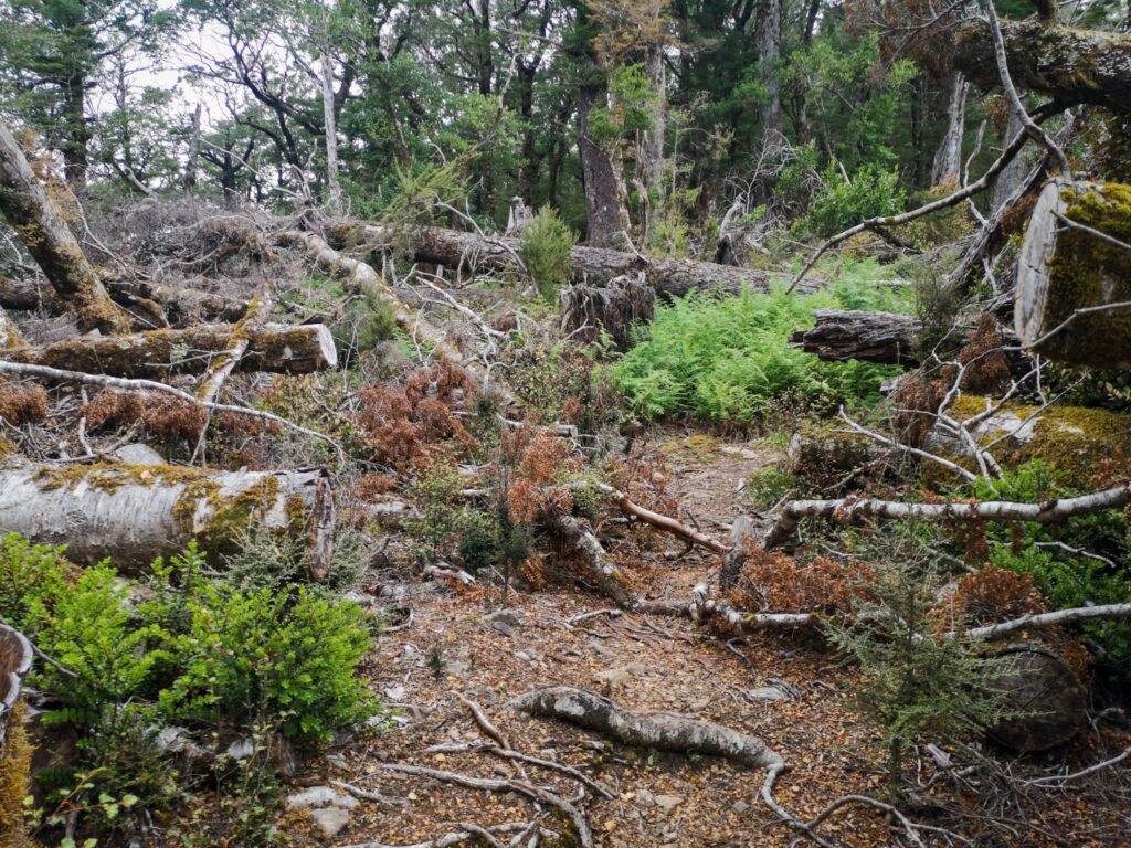
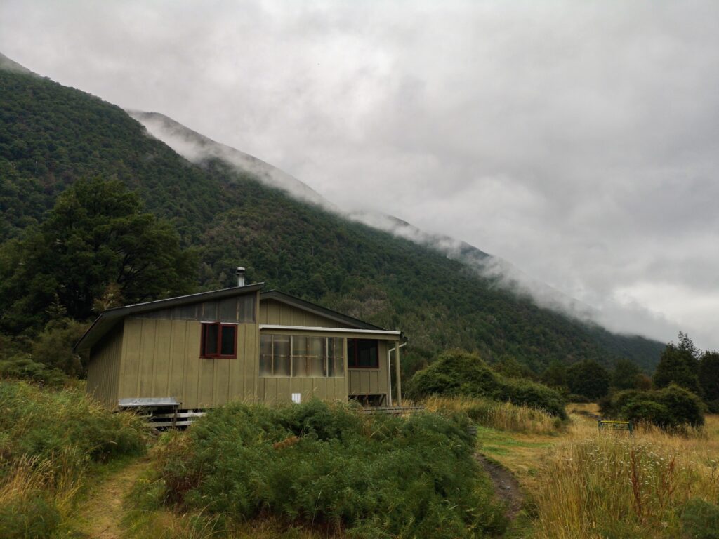
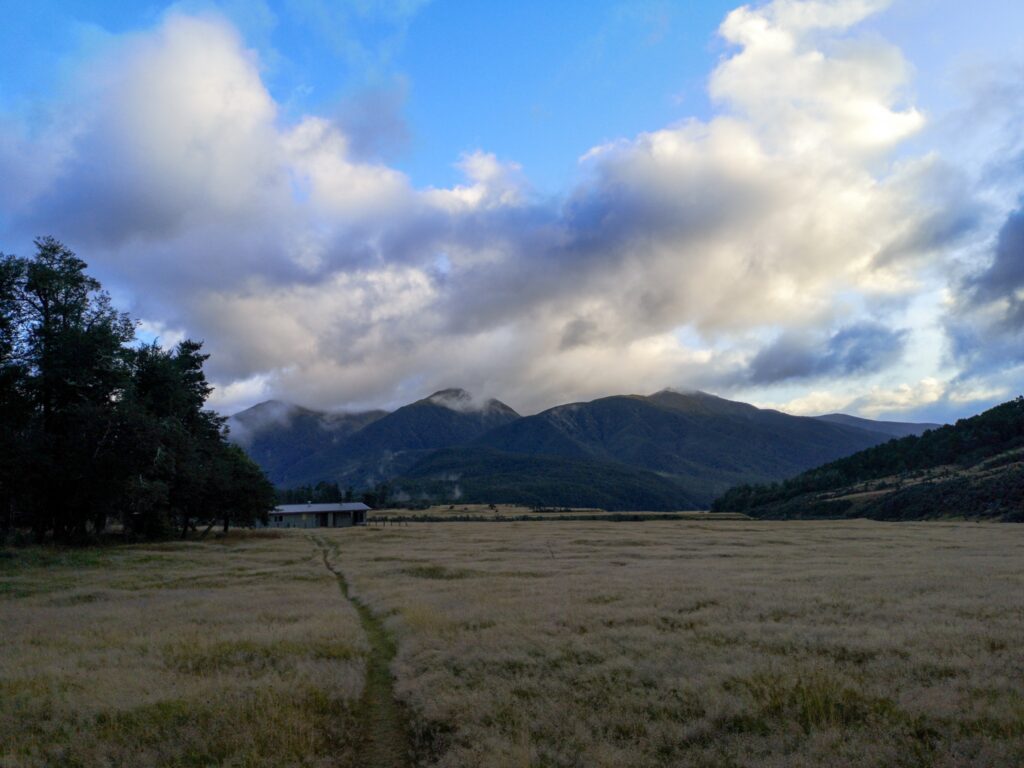
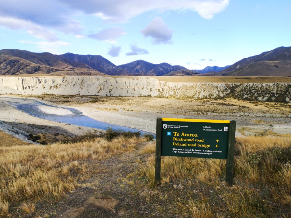
Pelorus River and Richmond Alpine Tracks (2020-02-19 05:46)
I started day 1 from Pelorus Bridge walking with Jim, an Irishman I had met on the QC. He was only intending to hike out to the first hut and then return as he only had a few days before he had to make his way home.
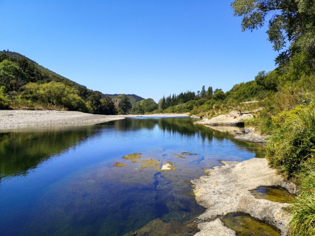
Pelorus Bridge was nice, with a good campsite next to the river and not too many sandflies. The cafe was open as well and I got to buy a chicken and camembert pie and a coffee. Great!
We had breakfast at the cafe and then set off. The track followed the road for the first ten or twelve km but then turned into a track at the end of the road. It was a lot rougher than the QC with some suspension bridges and a much smaller track. After about an hour we reached Emerald Pool where I decided to take a quick dip in the very inviting water. But the sandflies were really bad and after just a minute in the water I had to grab my stuff and we retreated further up the track and had a lunch of canned apricots that Jim had with him.
It was then a reasonably hard slog to Captains Creek hut where we stayed for the night. Again, it was a wonderful place, but it was impossible to stay outside due to the sandflies.
After a breakfast of chocolate digestives, Jim set off back down again and I kept heading south. Just before Biddy hut, I met a couple on the way down, but they were in a hurry and did not stop to say much.
At Biddy Hut I had an early lunch break and refilled with water.
The 5 km up to Rocks Hut were really hard. I had to stop at least 4 times to have a short rest. It is partly because I am not in great shape yet, but also because of the cold that I have had since the start of the QC. I haven’t wanted to tell anyone about it due to the Coronavirus scare, but I have had a mild cold for the whole trip and really felt it on this long upwards section.
A way up I met Ben, a NOBO hiker who stopped and gave some great tips about where and when I might have to send resupply boxes.
I finally made it to Rocks Hut and even though I had only done 10 or so km for the day, I decided that it was enough. I have to recover from my cold and begin slowly try to build up some stamina.
I ate peanut butter and apple sauce wraps and then walked up to the lookout where there was supposed to be phone coverage. I managed to update Instagram for the first time in 3 days so now people know I’m still alive at least.
I then returned to the hut and had some cold-soaked noodles. It is actually quite ok.
A hiker came through very quickly, Lewis, who was hiking all the way from Pelorus Bridge to Hacket Hut today!
He had been trying to set a new record for the TA but had been detained in the north by both sickness and bad weather. Apparently, somebody set a new record this year of 49 days.
Just when I was thinking that I would have the hut all to myself and was listening to an audiobook, Kerry an American girl turned up. She was hiking through to Queenstown and came up from Emerald Pool today.
I started out early from Rocks Hut, at 8. Slow going to start with as I felt far from strong, but the day went well with a stop for lunch at Brownings Hut.
It was generally good going, with some rougher sections and a bit of up. Mostly down though, which is going to make the start of tomorrow a hard climb, 900 m up!
Arrived at Hacketts Hut at around 2, had some peanut butter and then lay listening to Neverwhere.
Kerry turned up about 90 minutes later and as she had started after me, seemed to have done the same pace as me.
A little while later, a German girl, Victoria, turned up with warnings that there was a large group of German-speaking people coming up behind us. I have been enjoying being more or less on my own and am not looking forward to crowded huts so I hope they are taking it slow and remain behind us.
Still feeling far from strong and reading the trail notes for the coming days makes me realize that it is going to be hard work all through the next week!
Two more people showed up during the afternoon, Robert, a German hiker doing the full TA, and a kiwi guy heading out for just a couple of days.
During the night, the kiwi guy had what I assume was a nightmare and cried out loudly a couple of times in his sleep. Sleeping in huts can be challenging in many different ways!
In the morning there was much discussion about how far to go during the day in order to not end up in huts that were too crowded. The general consensus was that if we went all the way to Old Man Hut, 3 huts away, we should be able to keep the larger party following behind us. I just decided to start and see what happened, I would have to decide where I stopped depending on how I felt as the day progressed.
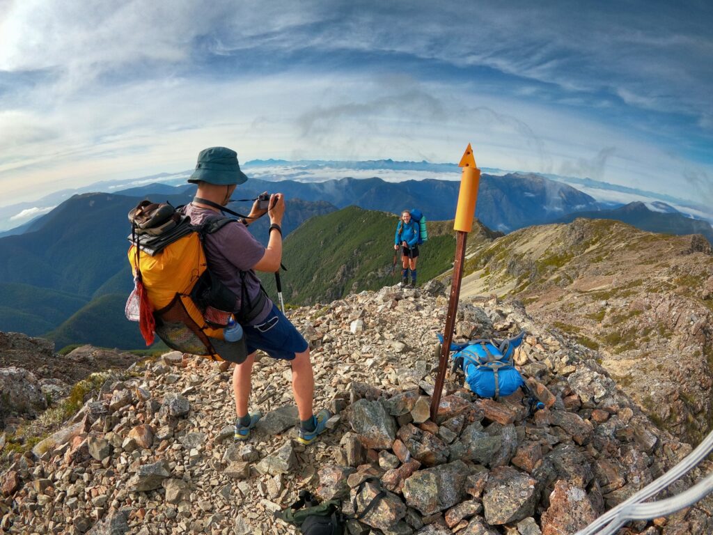
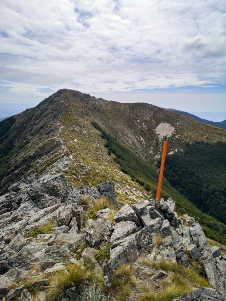
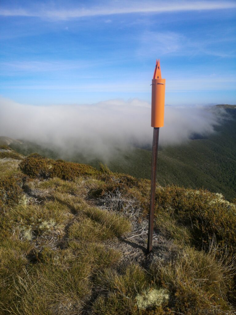
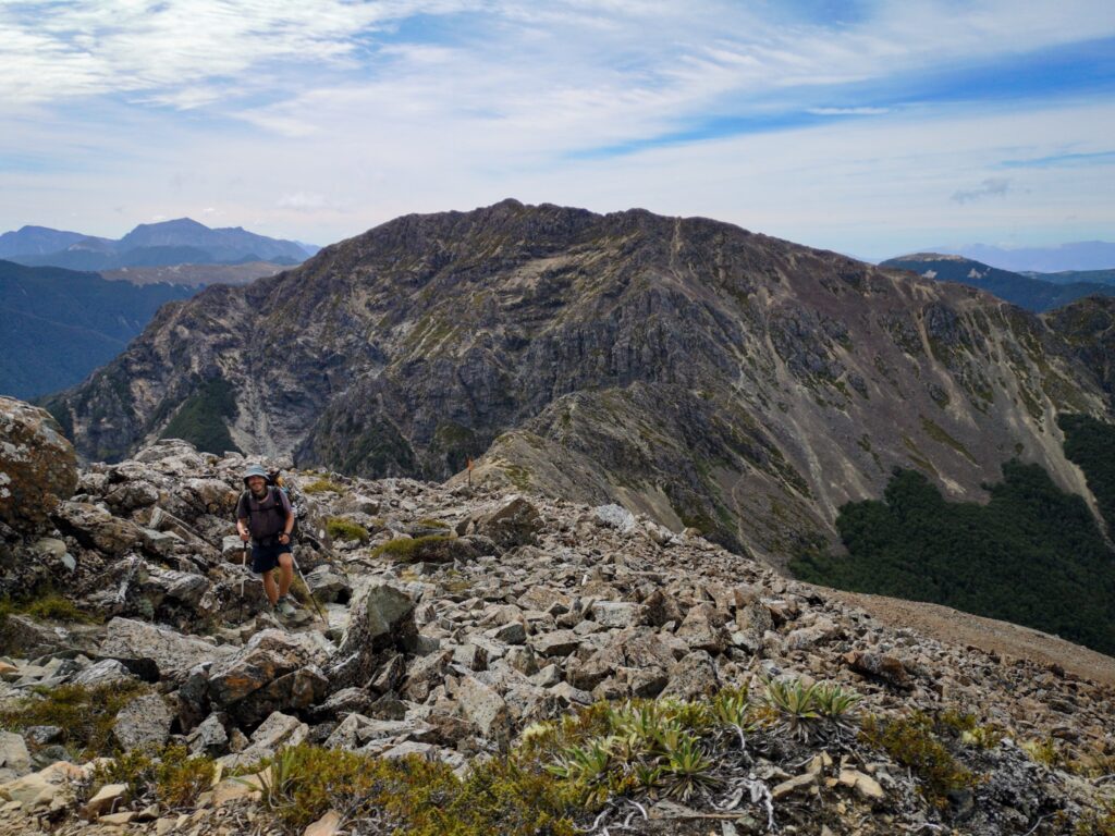
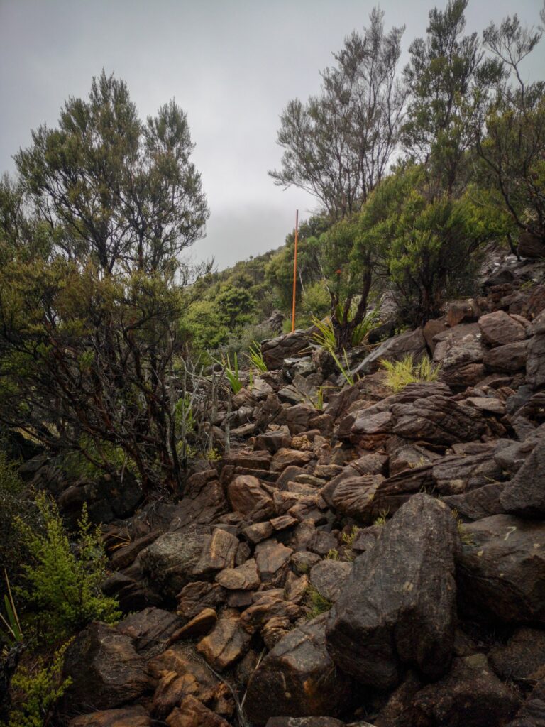
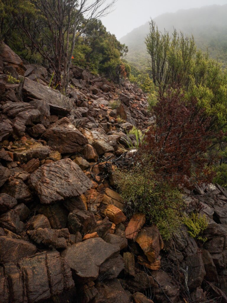
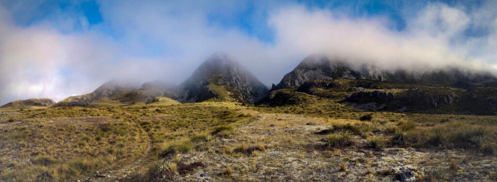
Well, it turned into a long, hard day. Only 21km, but with 1820m of climbing on some pretty rough, sometimes nonexistent, tracks, it was tough. But so worth it. Some amazing scenery and 3 different summits along the way.
It was Victoria, Robert and I that pushed on through the day and standing on a summit and looking back at the path we had taken, it was sometimes unbelievable that we had come along the tracks that we had. There was a bit of ridge walking and even some scrambling, almost rock climbing, and you needed to keep your wits about you and be careful.
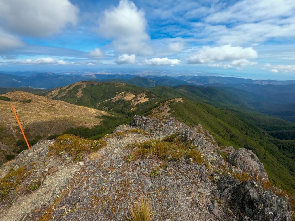
I was very tired climbing the last summit up to Old Man Mountain, having to stop and catch my breath every 5 to 10 steps. As I reached the top, there was a cloud slowly starting to cover the mountain and I was very aware that I needed to keep moving and get off the ridge before visibility became too bad. As it was, it never turned into a problem, but I was continually checking how far the cloud was behind me.
I also carried an extra 3 litres of water from Slaty Hut to Old Man as we had been told there was no water there. But when we arrived we found there was water, though not very much. I could have done with not carrying the extra weight, let’s just say that I was very tired when I finally arrived at Old Man hut!
There was an English couple already at the hut but there was enough room for all of us and I slept well that night.
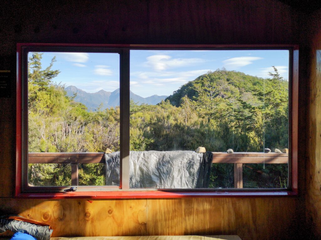
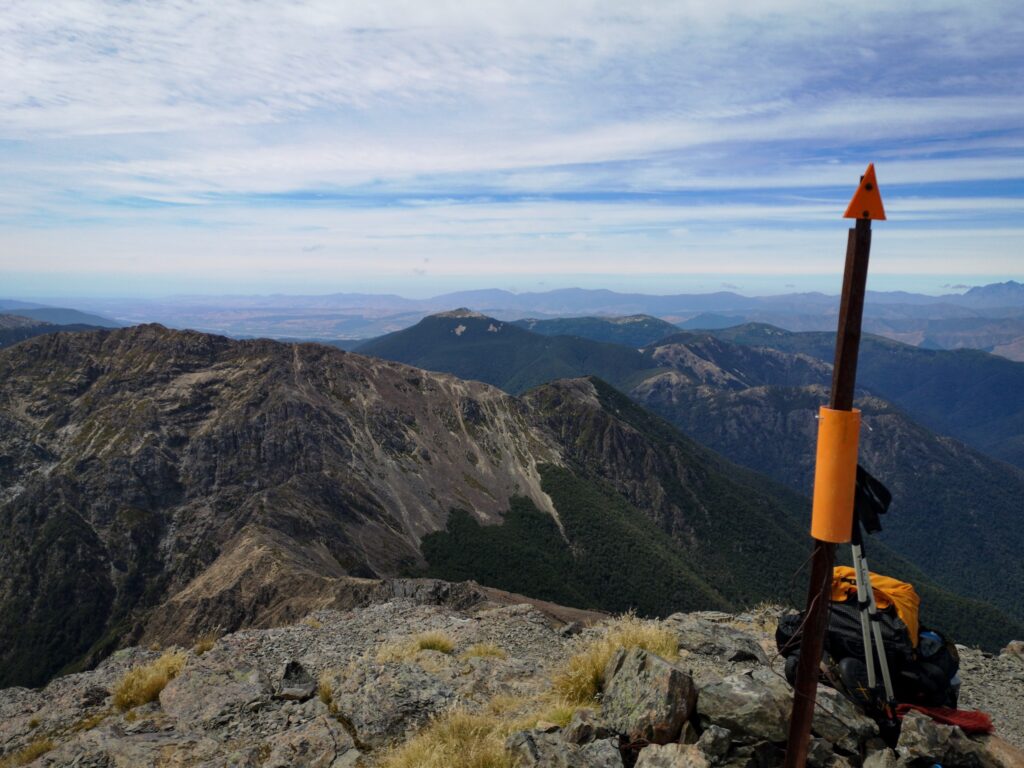
The next day we set off towards first Mt Rintoul and then Tarn hut. Another brilliant but challenging day. Only 1430 meters of climbing, but the days were starting to add up and my energy levels were not great.
But it was hard not to get inspired when looking out across the landscape.
Incredible!!
Again I had to carry extra water from Rintoul hut to Tarn hut as Tarn hut was out of water. This time it was correct, and I am glad I carried the extra weight.
The next day the rain started…
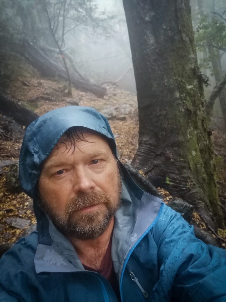
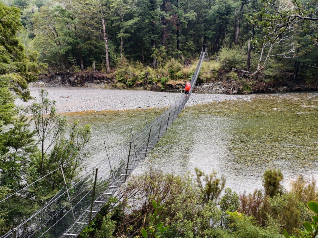
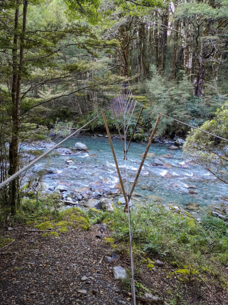
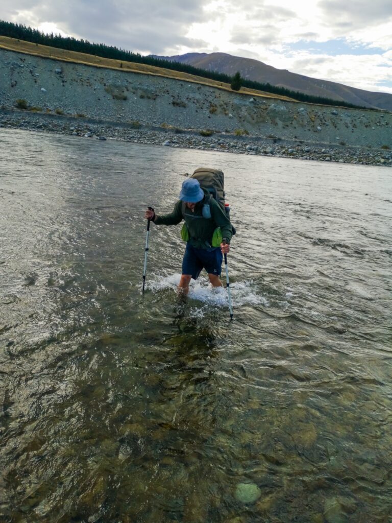
We walked through the morning from Tarn Hut to Mid Wairoa hut in rain and mist, through some pretty rough tracks. We then decided to stick closer together during the afternoon trek to Top Wairoa hut as it followed the river and entailed 8 river crossings. We all felt a bit safer knowing there was somebody close by if something were to go wrong and wanted to get this section done as we did not know if it was going to continue raining. If it did, it could make the river crossings difficult or even impossible.
It was a long wet afternoon and when I finally arrived at the steep climb up to Top Wairoa hut, I was wasted! I climbed up the gravel hill, past the toilet and could finally see the hut. There was smoke coming from the chimney and when I opened the door I was greeted by Victoria, Robert and another German couple that we had caught up to. Not only had the couple started a fire, but they had also boiled water and offered us hot chocolate. Talk about angels!
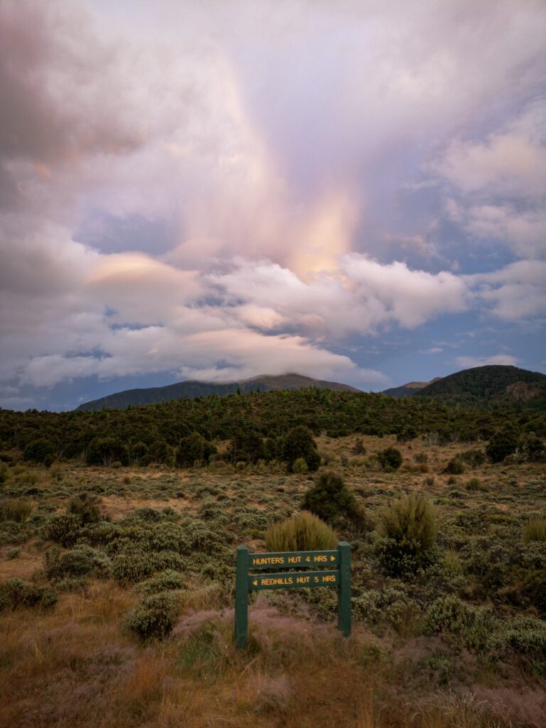
The next day was yet another day in rain and mist between Top Wairoa hut and Hunters hut, a bit more exposed and higher than the day before and there were several stages where you had to be careful to make sure you could see the next trail marking before you lost sight of the last one.
The afternoon from Hunter’s hut to Porters Creek hut was slightly better, not as wet and it actually started to clear up during the evening.
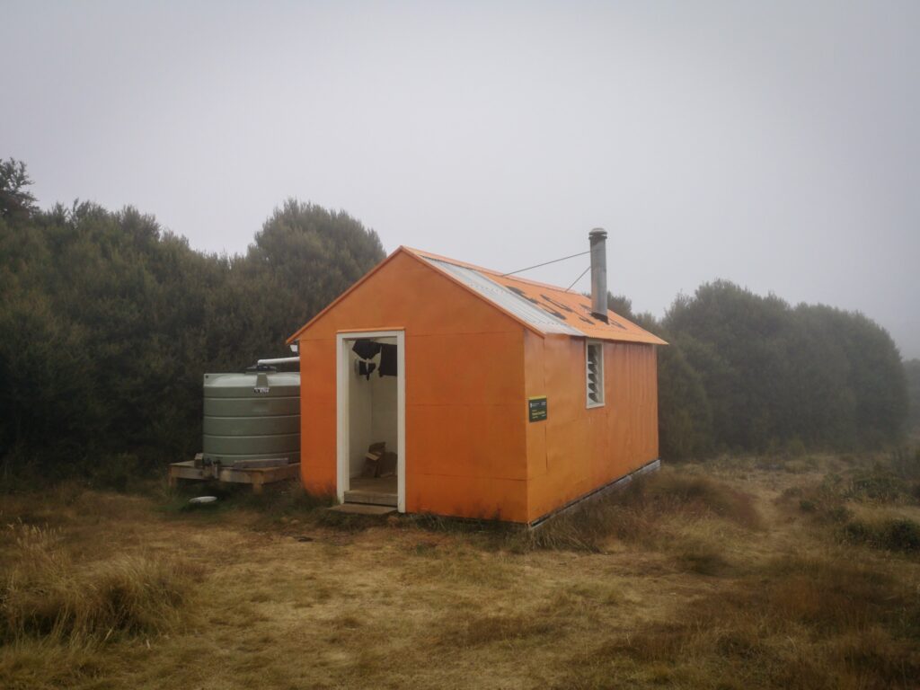
The last day started from Hunter’s hut to Red Hills hut and felt surprisingly good. I had eaten a double portion of noodles the night before and felt like I had a bit more energy. From Red Hills hut we had the option of taking the long way up and down the mountains, or the shorter Red Hills track just 7 km down to the road and then hitchhike into St Arnaud. With the weather being like it was, Robert, the German couple and I all took the short route and Victoria decided to stay the night in the hut and do the mountains the next day. Not really an option for me as I had absolutely no food left!
I had planned for 9 days but the food only just lasted 8, and even then I had probably not been eating enough each day to sustain the amount of walking and climbing that I was doing.
When Robert and I arrived down at the road, we were lucky to get a ride into St Arnaud almost straight away, a guy from the Netherlands stopped and drove us into “town”.
I am having 2 rest days here to shop and rest. I need food for 5 to 8 days for the next section and this time I want to make sure to have enough!
This hike has been great, even if it was tough. I would highly recommend it to anyone but just make sure you know what you are getting into, it’s not an easy hike!
I would have liked to do it slower if food and weather would have permitted, just to have been able to enjoy the outstanding scenery even more.
Now I have to head off and feed my hiker hunger with some burgers and beers in order to get my energy levels back up for the next section…
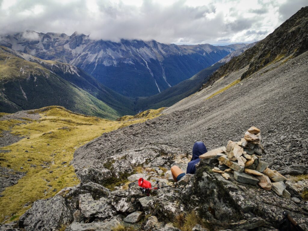
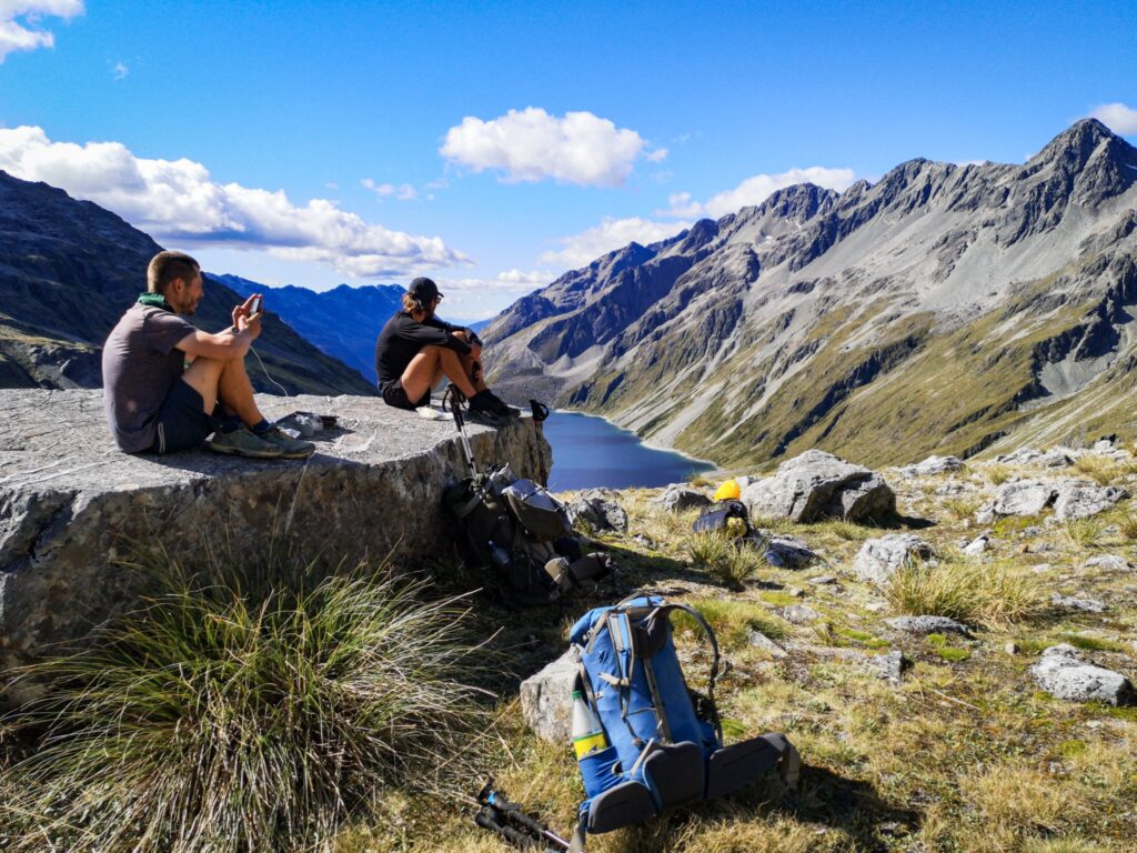
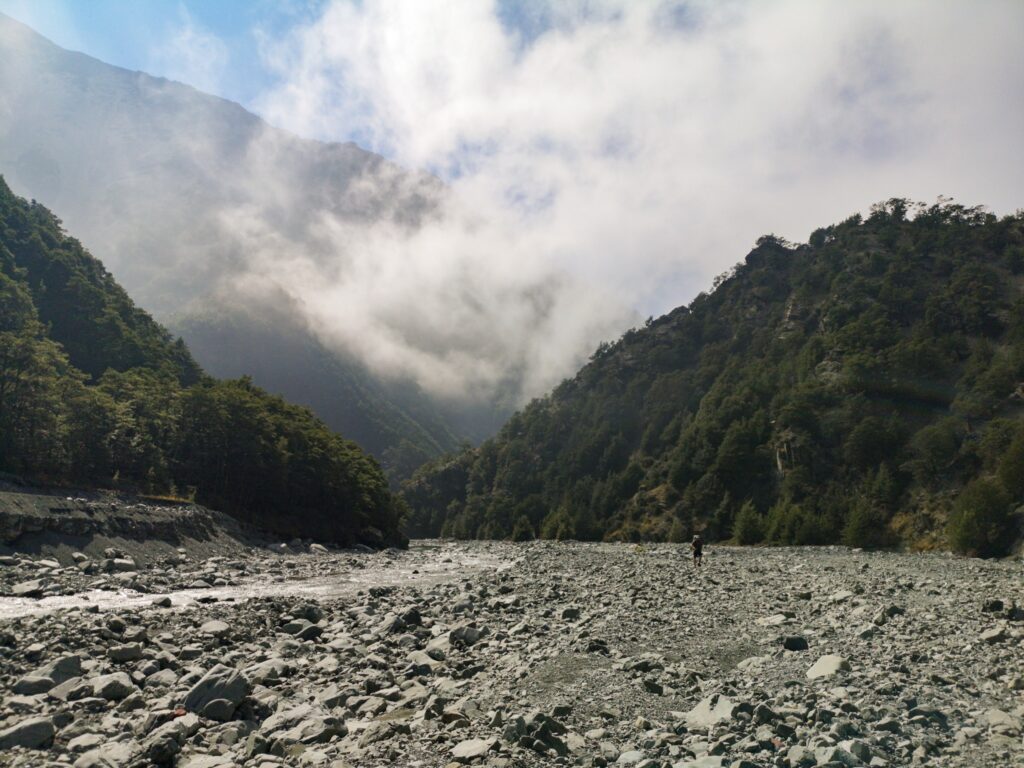
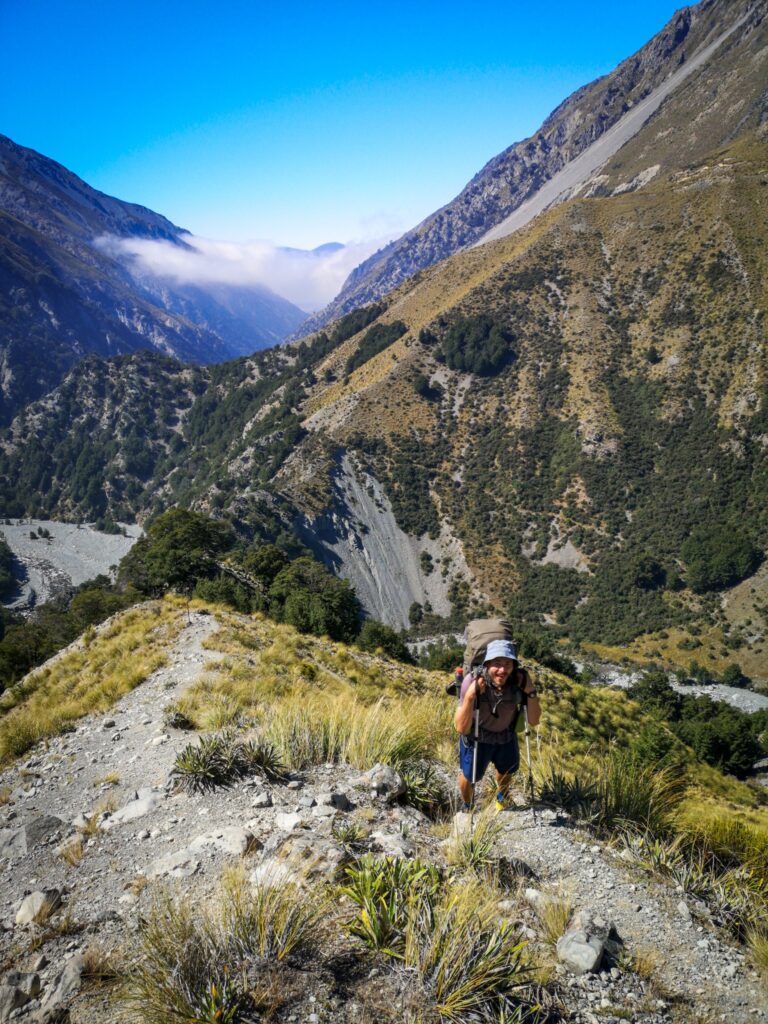
Waiau Pass Track (2020-02-27 04:52)
After 2 rest days in St Arnaud, I set off again together with Robert. This time with a heavy pack! The last 3 days of the Richmond Alpine track had been rainy and I decided to get a stove in St Arnaud. I also had way too much food as I had bought rations for 7 days, and then Robert came and gave me another 3 days. He had sent himself way too much food in his resupply box and rather than just leave it, I packed it on top of the rest of my gear.
The packs were heavy as we set off into what looked like a grey and dreary day. The first stop was Lakehead Hut where we stopped for lunch. There was a Canadian guy there that Robert had met on the north island, and he told us about staying out in the mountains for 51 days before returning to resupply!
After lunch, we headed to John Tait Hut, a 12 km walk but relatively easy. Once there it was time for a big dinner, had to get rid of all the food some way. It was way too heavy to carry.
Next morning was a nice walk to Upper Travers Hut but after that, it got a bit harder again. The track to West Sabine Hut starts off with a 450 m climb. Hard in and of itself, but you then have to come down again and the descents can be just as hard as the climbs, especially on the knees.
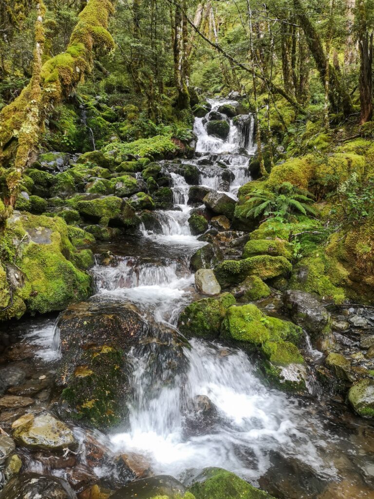
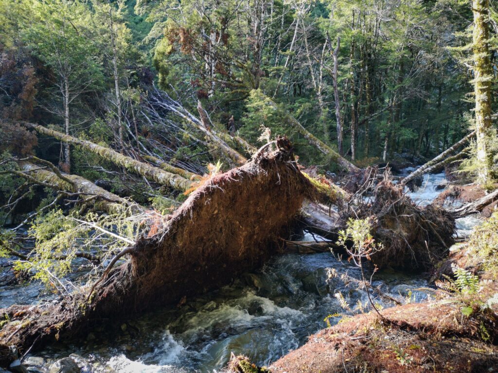
To add to the misery, it started raining, making all the roots and stones very slippery. Combined with some steep descents, you had to be very careful not to slip, it would be way too easy to twist an ankle or worse. Let us just say that my pace through here was very slow and I arrived wet and tired at West Sabine Hut late in the evening. It was a nice area to walk through, with luscious, almost tropical greenery and lots of moss hanging from the trees. It would have been even better in the dry though!
🙂
The hut was quite crowded when I arrived, must have been about 12 hikers there, most of them doing local sections and routes. It was almost a bit intimidating to begin with, but everybody was friendly, helpful and talkative and before long we were all sharing stories. Nice atmosphere.
Another hiker arrived even later than me, Chris from Poland. He is doing the complete TA and had come from Lakehead Hut that day.
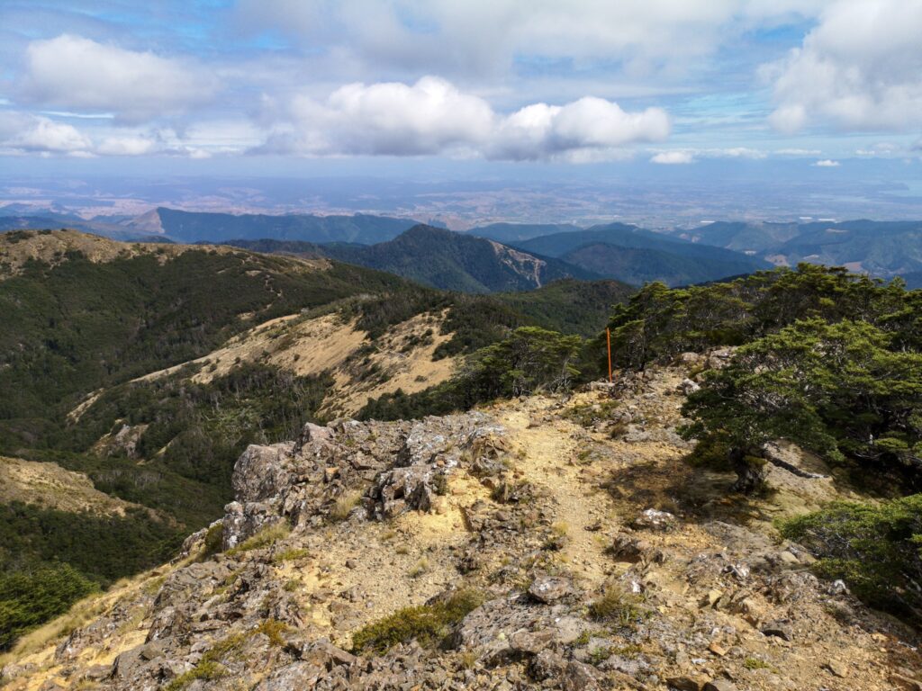
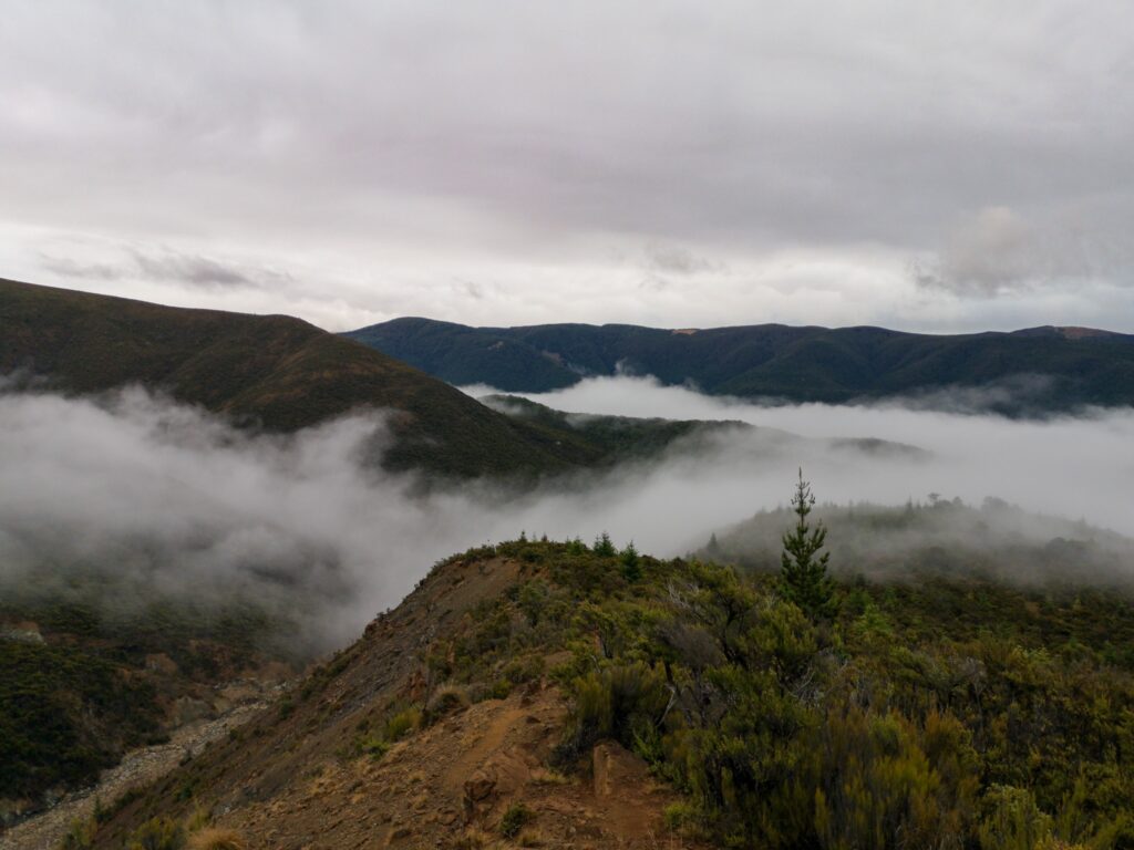
Day 3 was meant to be a reasonably easy morning hike to Blue Lake Hut, but I should have realized by now that nothing is easy in NZ, at least on the TA. Brilliant scenery but a rough track with a fair bit of climbing.
A quick lunch at Blue Lake and then it was time to set off on what we knew would be a more difficult section, Waipau Pass. By this time Chris, Robert and I were sort of hiking together. I would set off first and then they would both come tearing past me and I would catch them again when they stopped for a rest or smoke. Then the same thing would happen again…
We walked past Blue Lake and Constance Lake, climbed up above Constance Lake and then descended to it again along some very stony and slippery terrain. But beautiful!
As I walked along Constance Lake, I thought I could see a barely defined trail up ahead on the side of the mountain. Surely that is not the trail we are taking, I thought to myself, that looks ridiculous! But the closer we got, to more apparent it was that that was indeed our trail.
After walking along Lake Constance, the trail does a left turn and just goes straight up the mountain to Waiau Pass. No switchbacks here, just straight up… 550 m up…
So I watched as first Chris and then Robert set off while I ate some sweets and drank most of my water. I did not want to carry any extra weight. Then I set off after them, slowly.
But I was actually surprised how well it went. Sure it was tiring, but it was just a matter of taking your time, being careful where you placed your feet, and after a certain amount of time you reached the top. To stunning views, just totally stunning!
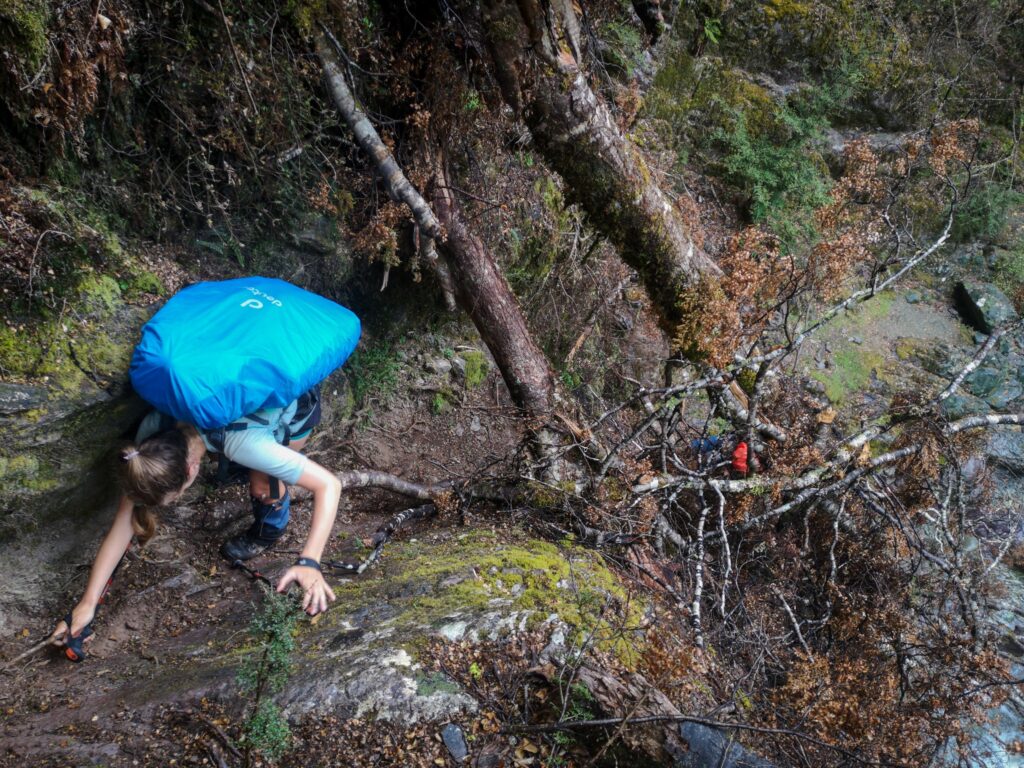
As has already often proven to be the case, the descent was almost more difficult. There are 3 or 4 sections of the southern descent of the pass where you have to turn around and climb down using both hands and feet. I’m glad I’m not afraid of heights and have done some climbing and scrambling before because it was not super easy.
I had to take it extra slow down the pass as I was being very careful with my “worse” knee which had been complaining ever since the Richmond Ranges. Nothing super bad, just a bit sore and not very stable, so I had to be extra cautious with my foot placements, a lot of the time almost backing down the pass in order to save my knee.
It took a long time and I arrived at an informal campsite down by the river to find that Robert, Chris and an American girl called Kelly had their tents set up and were starting a fire. I wasn’t all that sociable that evening, I set up the tent, had some dinner and a short talk with everyone and then lay down on my very comfortable mattress to sleep. No problem that night…
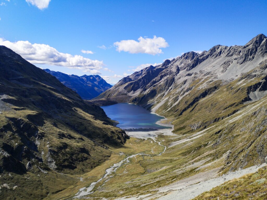
The next day was a long day, 36 km to Anne Hut. Anne Hut is a newer hut and sits in a beautiful valley with great views of the surrounding ranges. Along the way, Robert stopped to camp and swim and only Chris and I made it to the hut that day.
Day 5 was just transportation out of the mountains, down to Boyle River Village, another 32 km. No tracks here are “easy”, but it was a nice walk and Chris and I arrived at the road in time to try to hitch to Hanmer Springs. I was planning to have 2 rest days there to enjoy the warm spring water baths and let my knee recover a bit. We were very lucky and got a lift after just 20 minutes and the super kind driver, who had turned around to pick us up, drove us the extra 10 km into Hanmer Springs although he was actually going past it. People are so friendly in NZ!
As I write this, it is at the end of my 2 days in Hanmer Springs and I am going to try to hitch back to the track tomorrow morning. It’s been great to relax, eat a lot of food and visit the thermal springs, but if I’m going to reach Bluff I have to keep going. My knee is still a bit sore and swollen, the backpack is heavy with food again, but I’m looking forward to some great new views.
Keep walking…
🙂
Harper Pass (2020-03-05 02:03)
Hanmer Springs to Hope-Kiwi Lodge:
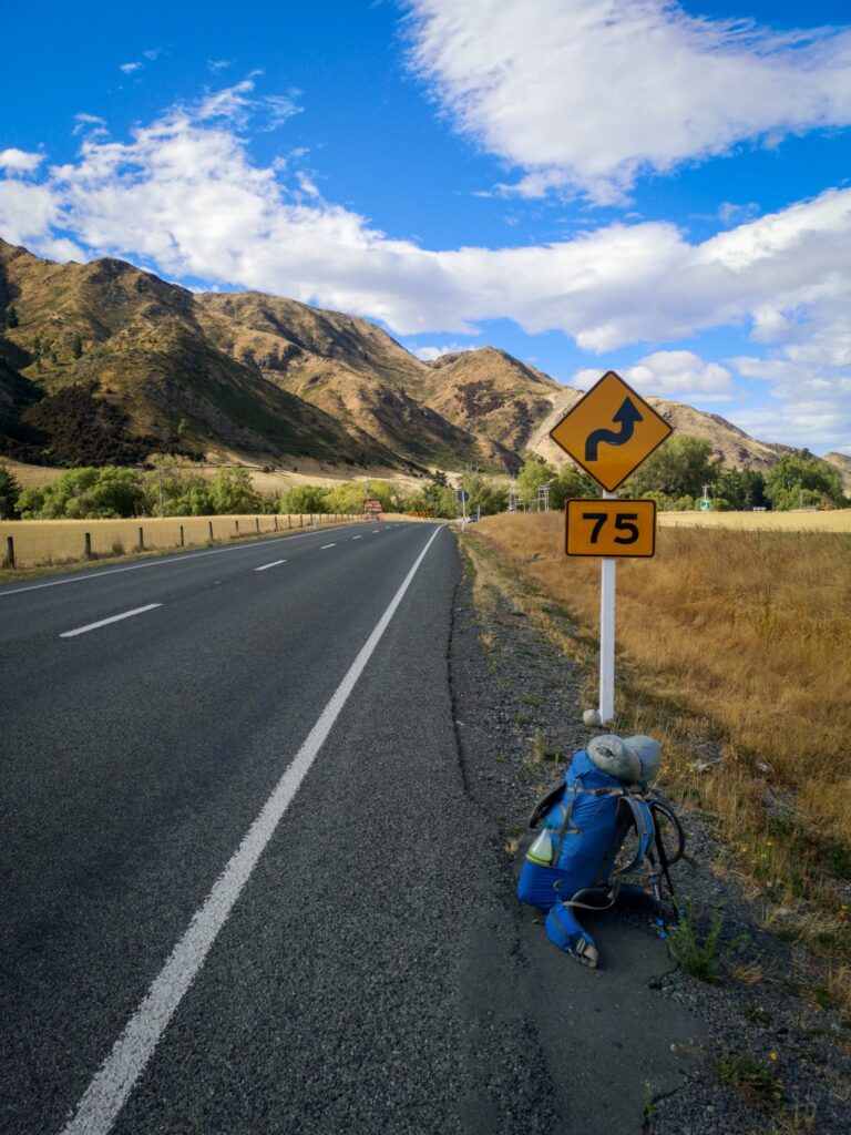
Hitching is easy in NZ. I did have to wait almost 45 minutes in Hanmer Springs before I got a lift out to the main highway, but a truck driver eventually picked me up. I was a bit surprised that a truck would pick me up, but the driver had just been to physio across the road from where I was standing and was already stopped. He did have to make a pick-up on the way, a tractor on a trailer being returned for trade-in, but that only took a few minutes and I was out at the highway in no time. Well there, I hardly had time to set the pack down and take a photo before I got a ride to Windy Point.
The weather was starting to look a bit grey, after having been nice all morning, but the forecast was for afternoon rain so it was to be expected.
It was a reasonably easy walk, about 18 km, to Hope-Kiwi Lodge, mostly following the river and it was just a matter of getting it done.
I didn’t feel very strong, despite the rest days and I was feeling pain in my left knee. I had hoped that both I and my knee would have been better after 2 days in Hanmer Springs, but that did not seem to be the case.
I had a full load of food again but, surprisingly, the backpack did not feel all that heavy. At least I seemed to be getting used to that.
I had a small plan to hopefully be able to walk all the way to Rakaia River this time, and from there make my way to Christchurch for one or two rest days and to change some equipment. But the way my knee was feeling, I started thinking that I might have to make my way to Christchurch from Arthur’s Pass instead.
There were some small showers during the afternoon, but I managed to stay dry up until the last half-hour when it started raining properly.
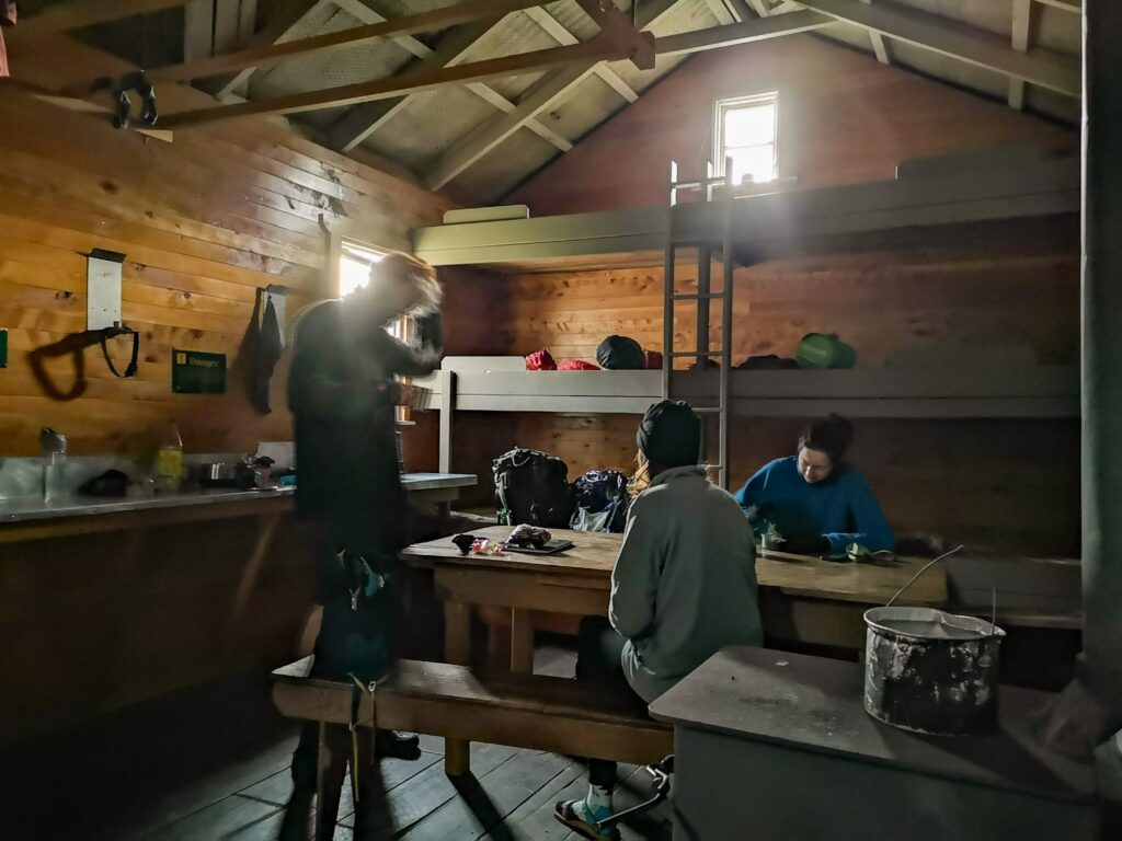
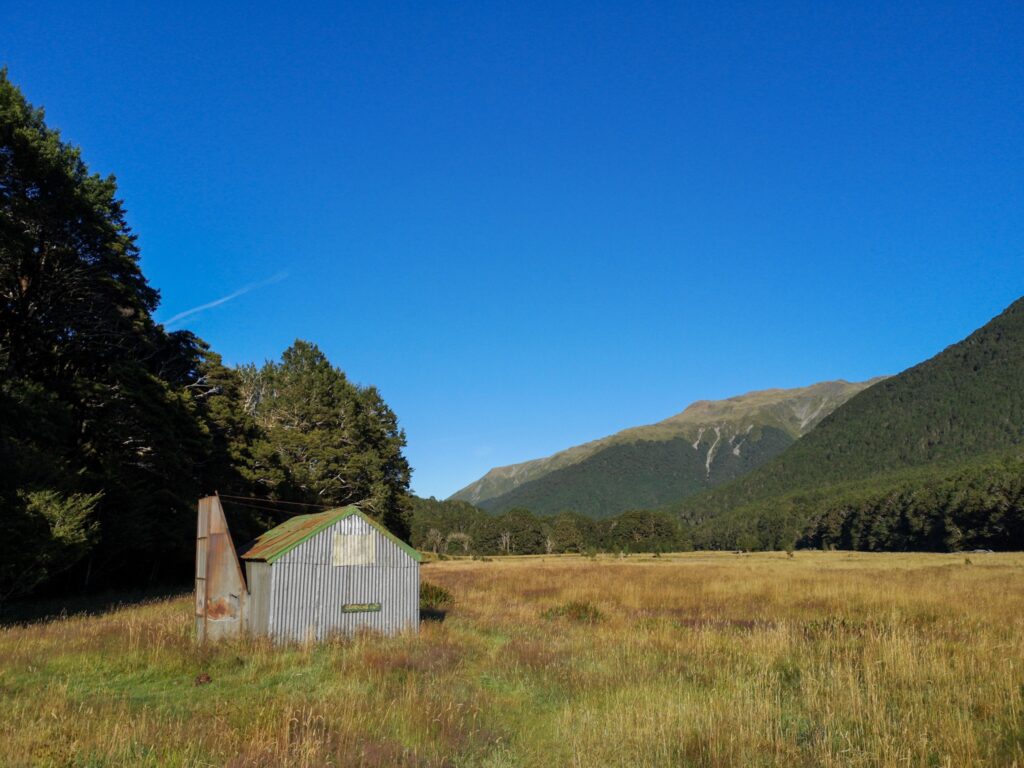
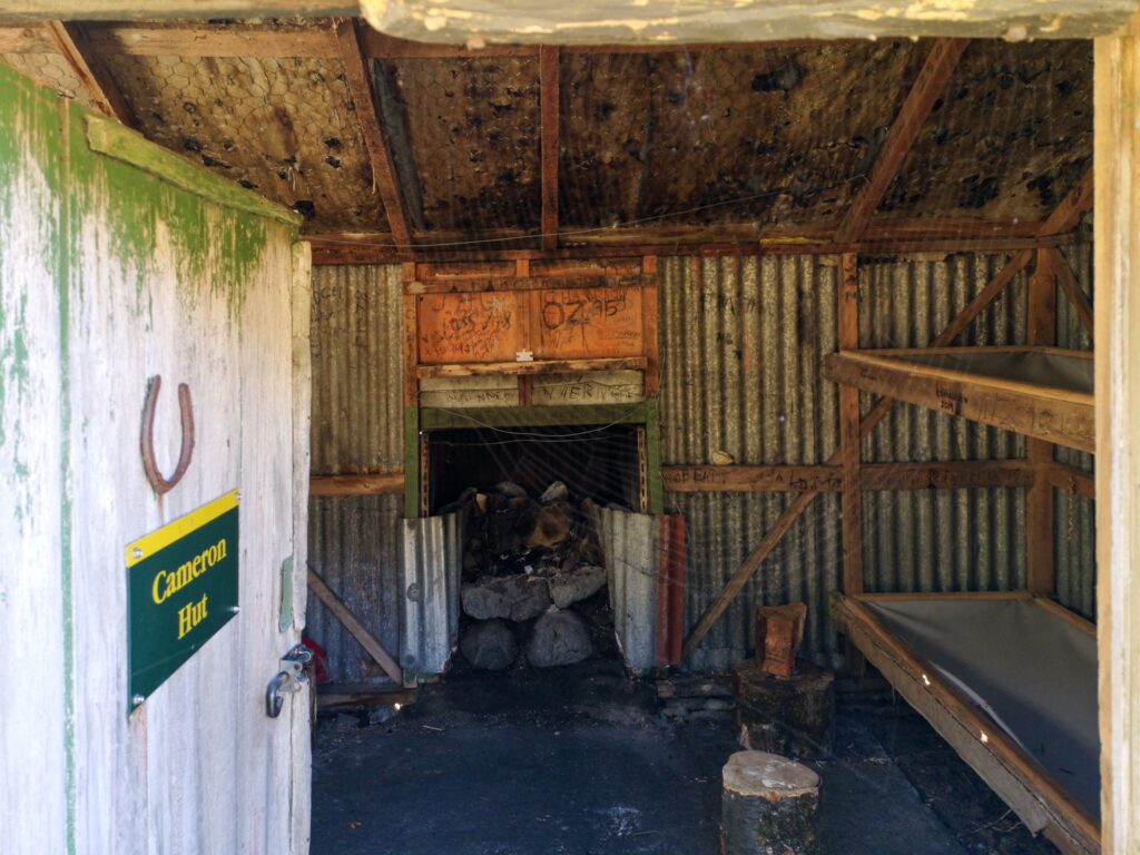
It was nice to reach the hut and it was empty!
I made some dinner, beef stroganoff, had some tea with honey and lay back to listen to “A gift of time”.
Just as I was more or less sure that I would have the hut to myself, a Dutch and Belgian couple, Guido and Hannah, turned up. I had met them earlier at and after Anne Hut and they told me that Chris might be on his way behind them.
Hopefully, tomorrow will start out with some rain and then start clearing up and my plan will be to get an early start and try to get some miles done in order to see what my knee feels like.
On the other hand, if it’s raining too hard, I might just stay here, it’s a nice hut!
Hope Kiwi Hut to Hurunui Hut no 3:
I started early in order to be able to make it to Hurunui no 3 before dark. It was going to be a long day, but I wanted to make sure I made it to Arthur’s Pass before the rumoured rain started
I made it to Hurunui no 5 for lunch and set off after just a short break because I wanted to have time for a soak in the hot pool that was supposed to be halfway between the huts.
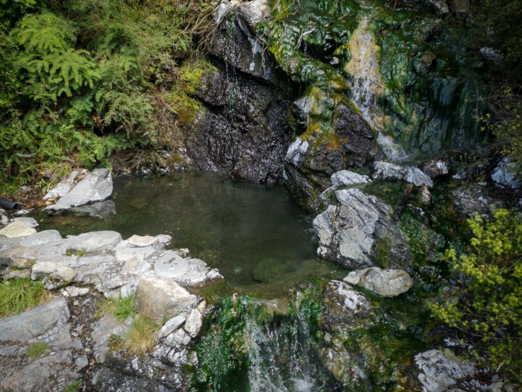
When I got there, I quickly jumped in and enjoyed the heat soaking into my tired legs. Unfortunately, it only took a few minutes before I was being eaten alive by sandflies!
Getting out and getting dressed was even worse, I’ve never seen so many sandflies in one place.
I pushed on to Hurunui no 3 hut and found Christi and Mairead there. Later in the evening Hannah and Guido turned up as well. They had decided to try to make sure they weren’t trapped on the wrong side of the river if it started raining.
Hurunui no 3 to Kiwi Hut:
Everyone had decided to get to Kiwi hut the next day, in order to be able to cross the river and get off the trail before it started raining on Tuesday.
I started out first, as usual, and was expecting everyone to pass me before Locke Stream Hut, but for once, I made it there first. We had lunch on the veranda, in the sun, and headed out towards Kiwi hut.
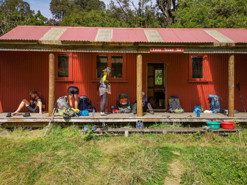
The first river crossing after Locke Stream Hut was the first harder one and actually turned out to be the one with the strongest current on the whole section. I managed to get over ok, but in the middle, I was thinking to myself that I would not have liked for it to be any stronger!
I was expecting everyone to catch me pretty quickly, but they had found the river crossing a bit much as well and it was quite a while before they reached me.
We all got to Kiwi hut at about the same time and settled in for the night. Later in the evening, 3 more hikers turned up. The first northbound hikers we had seen for a while and we asked a lot about the upcoming river crossings.
Kiwi hut to Aitkens:
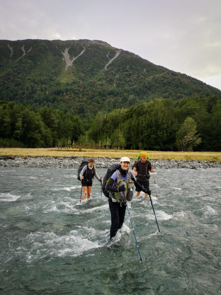
The next day was supposed to be easy, but with a couple of bigger river crossings and a trail that was very poorly marked, we stuck together and took our time. You couldn’t really get lost as you only had to follow the river, but a lot of sections were washed out and you had to scramble through the undergrowth or climb along the river bed.
For the first bigger river crossing, we linked up and crossed over together. Nice and safe and no problems!
The next and last one before we arrived at the road, we did without linking up as it was a bit easier and we were all relieved to be almost back in civilization.
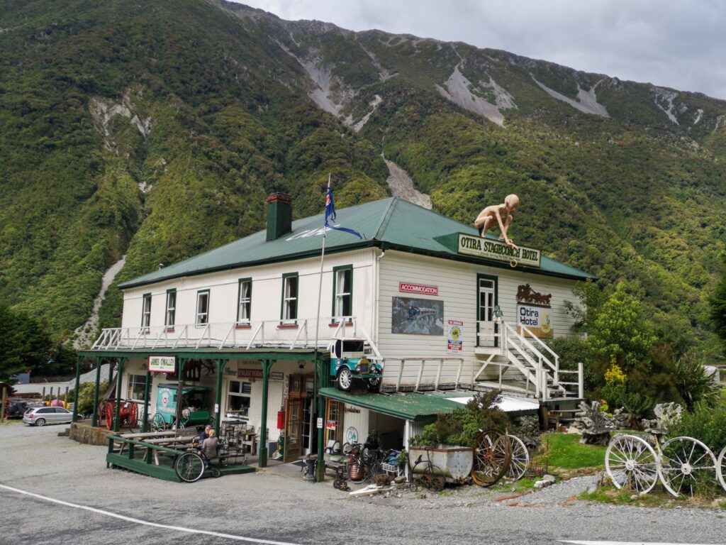
It took longer to hitch to Arthur’s Pass than at any hitch earlier but we finally arrived there after a short lunch stop at the Otira hotel.
It turned out that Robert had got there an hour before me and Chris turned up 2 hours later. Everyone was in the same place and we decided to have dinner together that evening.
In the end, there were about 10 TA hikers in the cafe that evening and it was a very nice night. Good food, good company, beer and lots of stories to share!
It turned out to have been a very good decision to get off the trail, as it was going to start raining heavily the next day, making the river crossings difficult or impossible. I decided to take the bus to Christchurch, rest my knee and try to plan for the coming sections.
Christchurch:
After a nice bus ride to Christchurch, the first thing I did was to buy a new backpack. My Exped pack was working well, I was surprised how well it carried quite a large load, but I was missing having more pockets to organize my stuff in. Most lightweight backpacks only have one large compartment and it turns out that I am the kind of guy who wants several smaller pockets in order to be able to know what is where and get my hands on it quickly. It just makes life so much easier when you are living out of your backpack. I also wanted to try a new type of backpack that has pockets on the front and distributes the load more evenly around your centre of gravity, supposedly making it easier to carry and giving you better balance. Both Mairead and Christi were using them and liked them. As they are designed just outside of Christchurch, I thought that if nothing else, it would make a good souvenir.
🙂
I’ll let you know how it works as I get a few miles done with the new pack…
I’ve spent today organizing bus tickets and transfers as well as buying food, and tomorrow Robert and I are taking the bus back to the trailhead. We will miss Goats Pass, but I can always come back and do that when I come back to Christchurch after reaching Bluff (if…).
We have transport organized between the big rivers ahead and should be out on the trail for about a week, so don’t be surprised if you don’t hear anything for a while!
Keep walking…
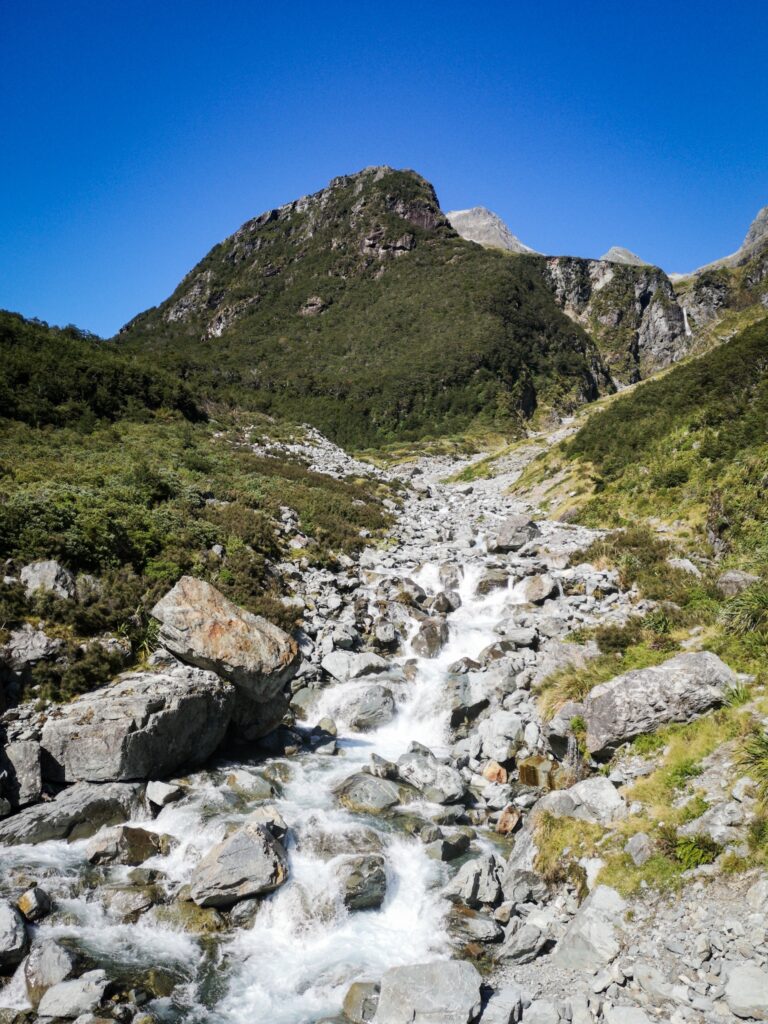
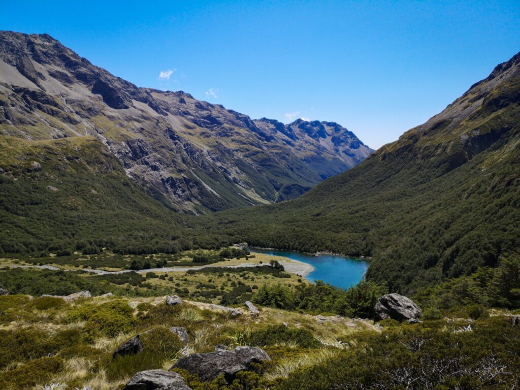
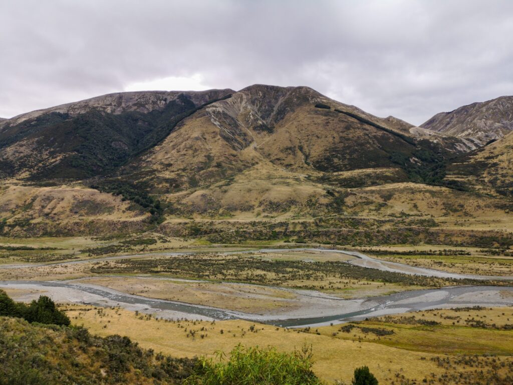
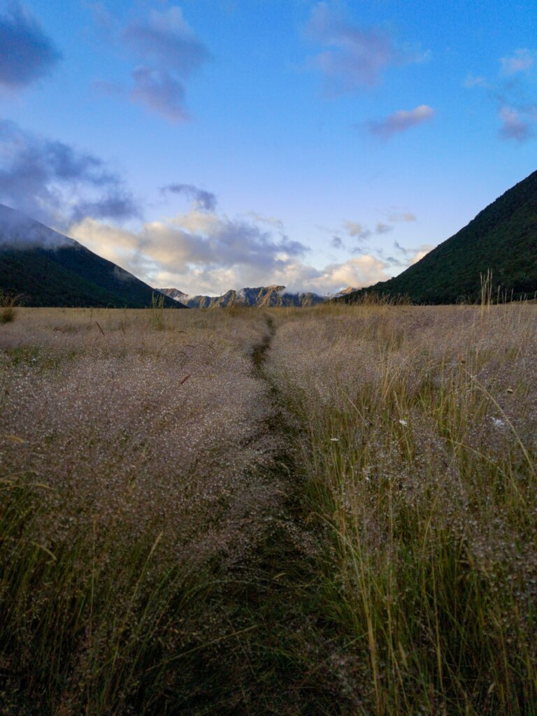
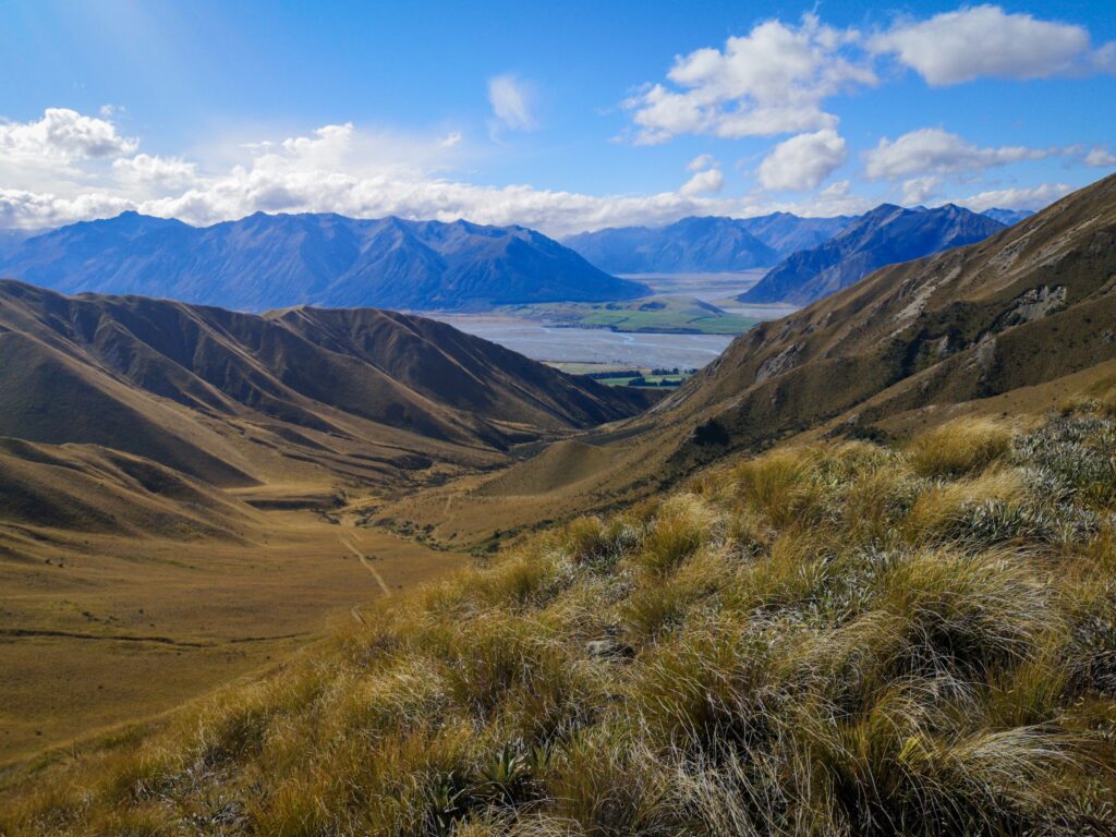
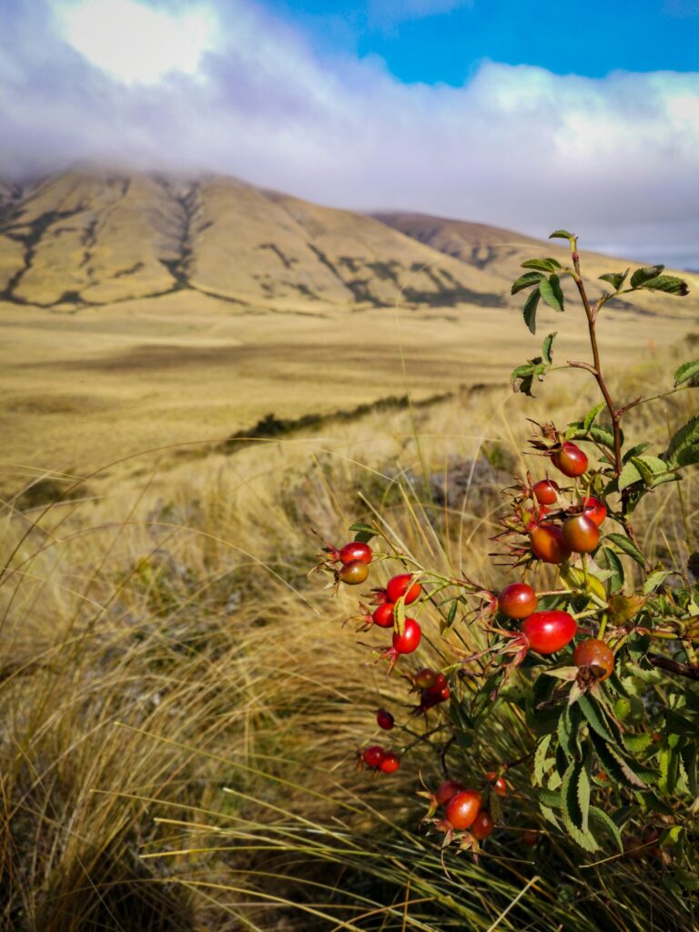
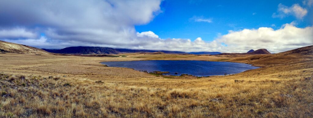
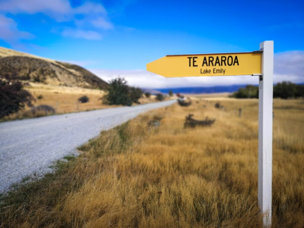
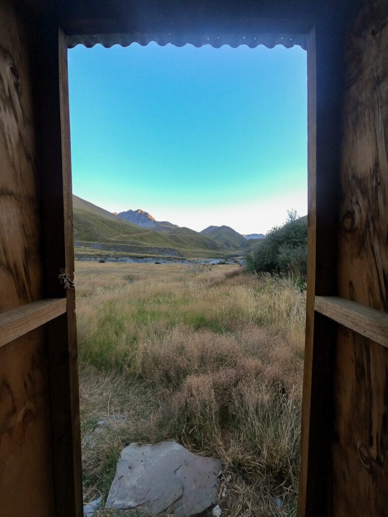
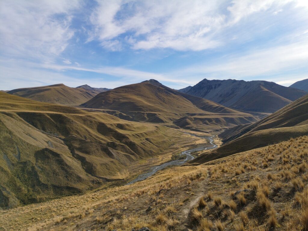
Boyle to Lake Tekapo (2020-03-16 03:22)
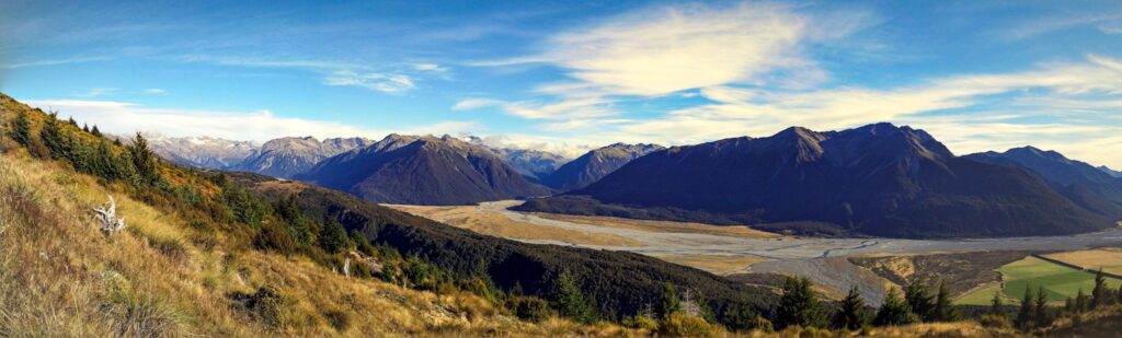
This is not going to be much of a blog post, more of an image dump.
🙂
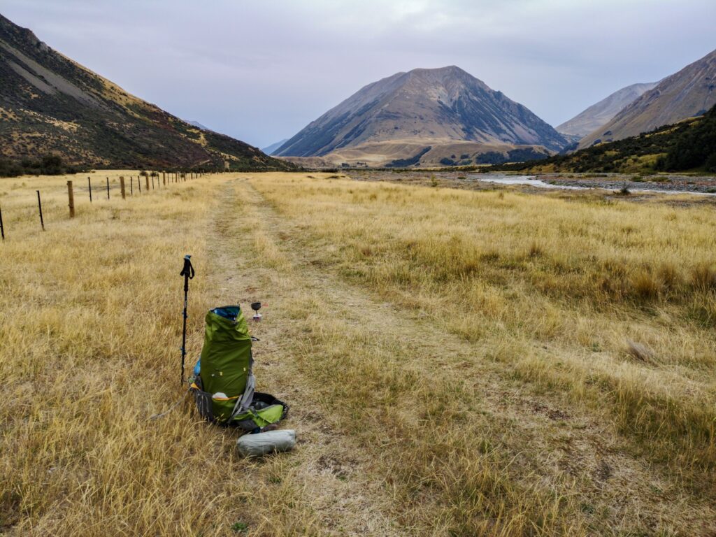
I have just spent 9 days on the trail getting from Boyle to Tekapo Lake and can now say that I am halfway down the South Island.
My new pack is working well and I am starting to need my warm quilt as the night temperatures are starting to get lower.
I also changed to a new set of shoes a few days ago as my old ones had taken a huge beating from all the river crossings. I can honestly say that I have done more river crossings in the last couple of weeks than in all my life earlier!
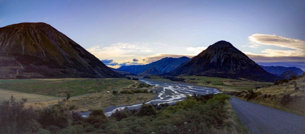
The scenery has been stunning and the weather not too bad. Some rain but nothing very heavy.
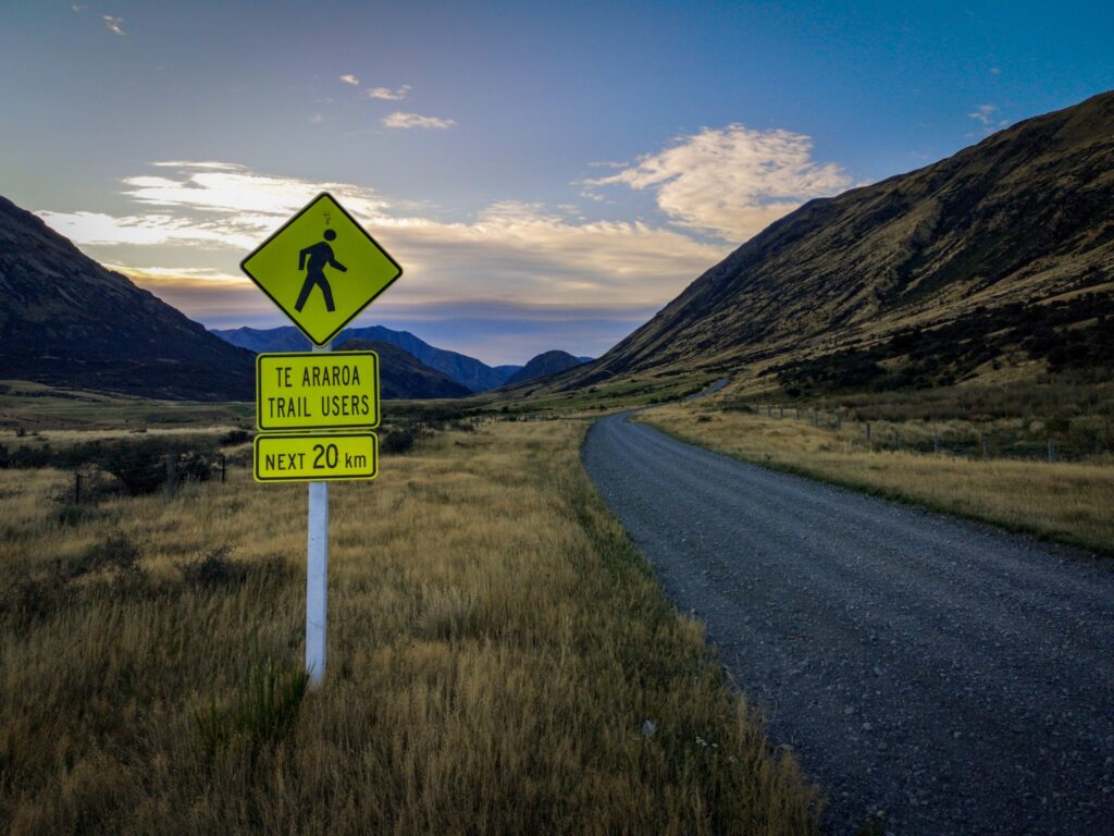
There has been some road walking along gravel roads, but not too much.
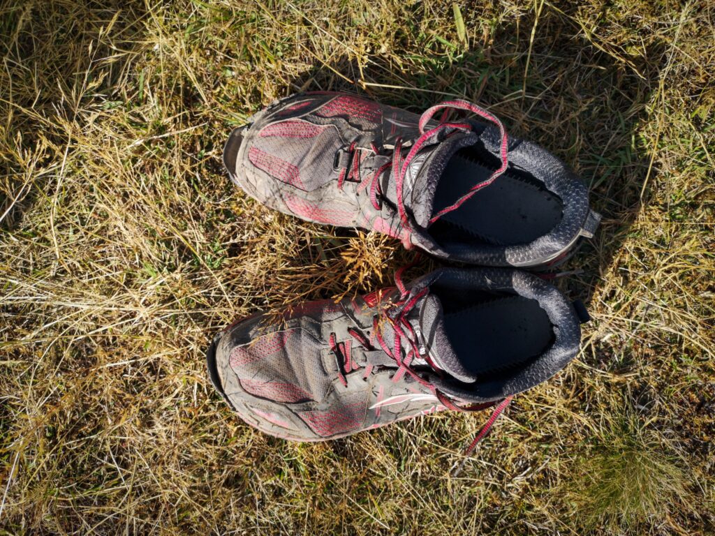
Well worn Altra Lone Peaks…
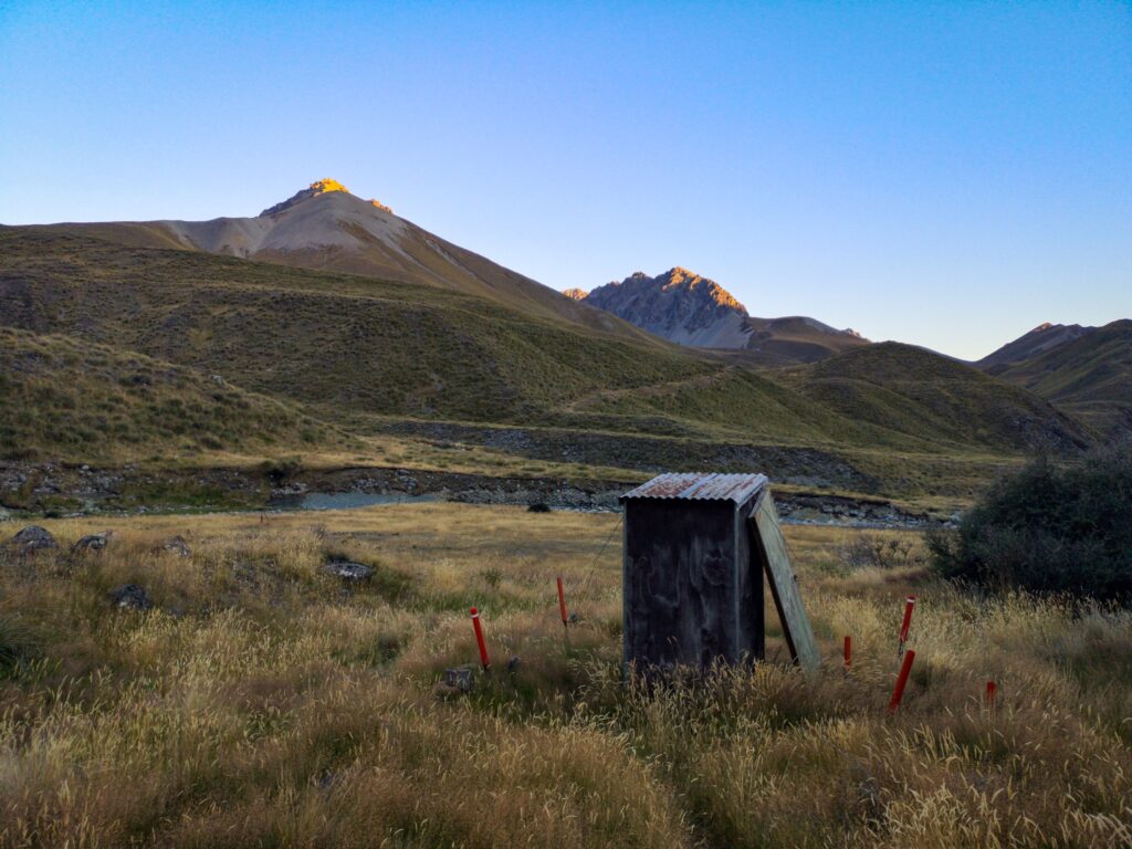
My favourite toilet so far, with a view!
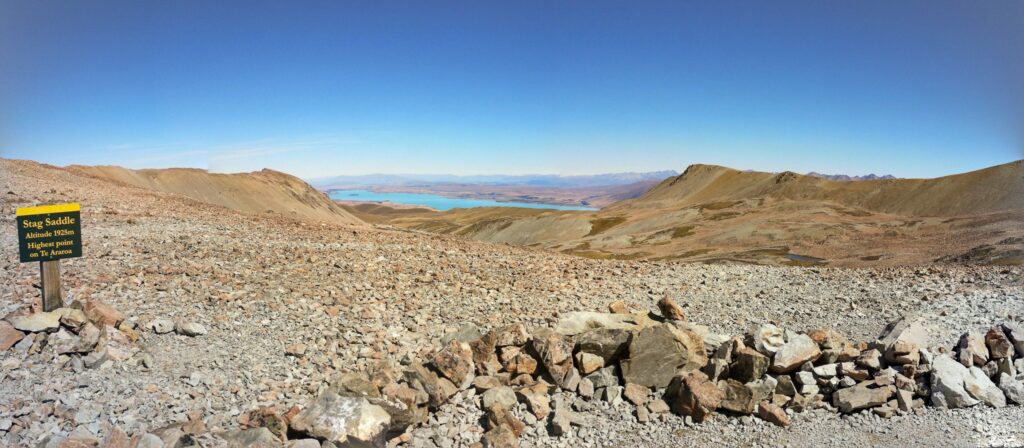
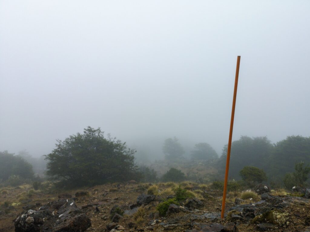
The highest point on the TA
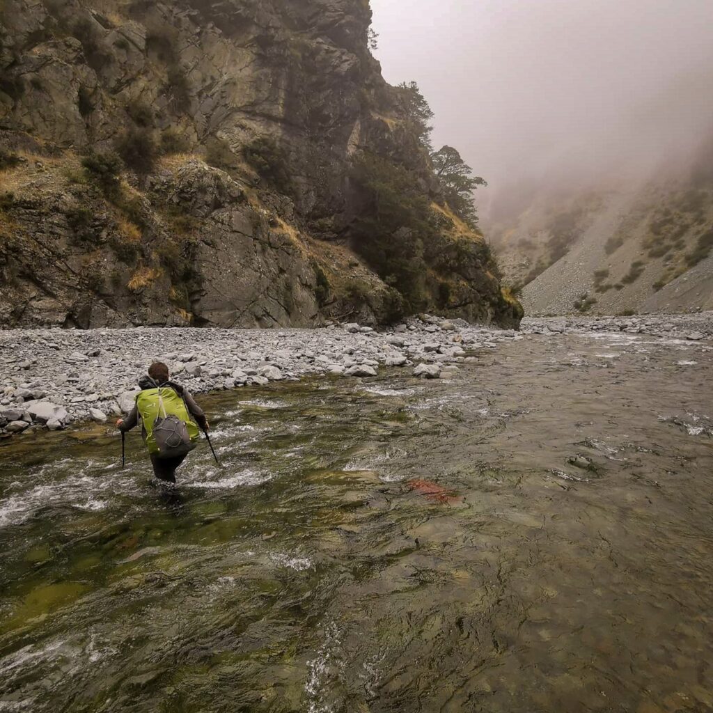
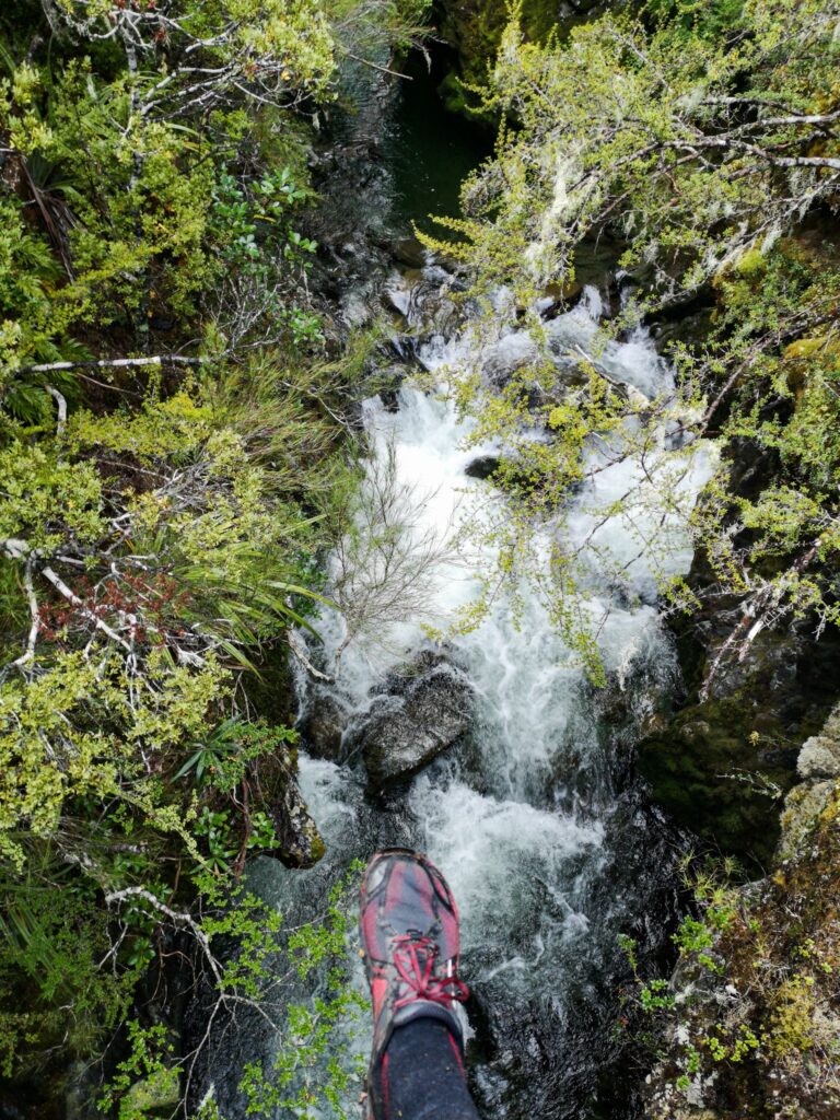
One of many, many river crossings
I am continuing south tomorrow on a hire bicycle. The next section of the TA follows a canal and is a bit boring to walk, so Robert and I decided to do it on bikes. That way it will take us just one day rather than the three it would take to walk.
I’m also expecting tomorrow to mark a milestone in the project that I call the-walk…
But more about that on Instagram tomorrow!
🙂
Lake Tekapo to Wanaka (2020-03-23 06:29)
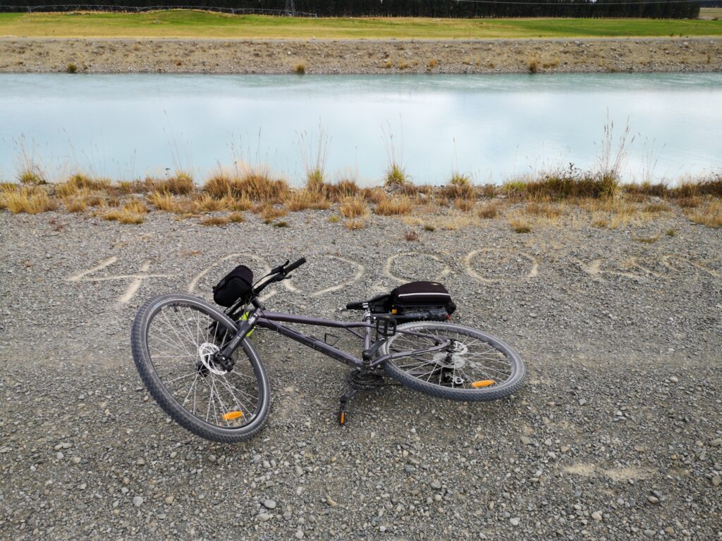
After a well-deserved rest day in Lake Tekapo, it was time to set off on the trail again. Robert and I had decided to hire bikes for the next section, a 90 km ride along mostly canals and roads. It was nice to cycle along quietly and enjoy the scenery. It would have been a lot more boring to walk so, all in all, it was a good decision to hire the bikes.
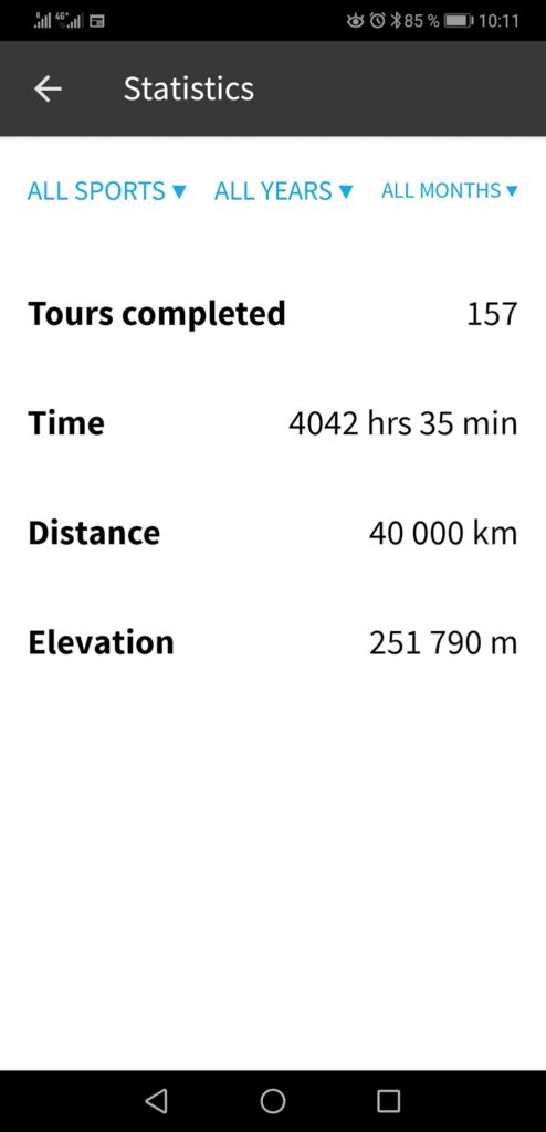
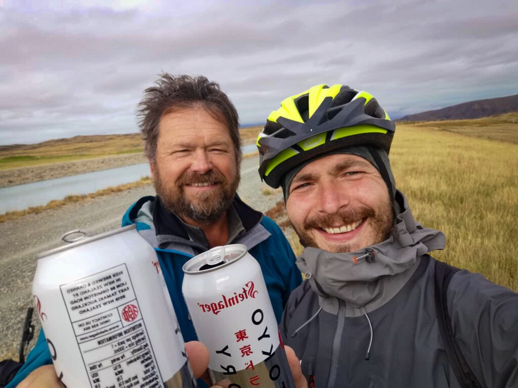
After less than 17 km it was time for a break that marked a milestone in my project the-walk. I had reached 40,000 human-powered kilometres! Not bad considering that almost 27,000 of those kilometres were walking.
I hadn’t really intended to celebrate 40k, but it actually felt quite good to stop and make a bigger deal off it. Robert had brought a couple of beers and we ate some chips and had a drink while taking a few photos.
Further down the road, we found 2 large whirlpools, sucking water from the dam and further down the canal. They were very impressive, especially when we could see just how much power was released on the other side of the dam.
We stopped for lunch in Twizel and after some really rough gravel roads, found ourselves on the alps2ocean bike track. It was a big improvement and the riding become interesting and pleasurable.
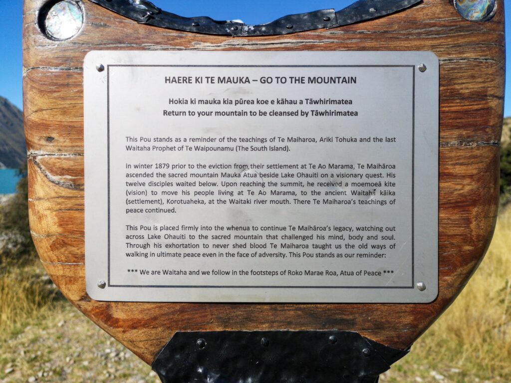
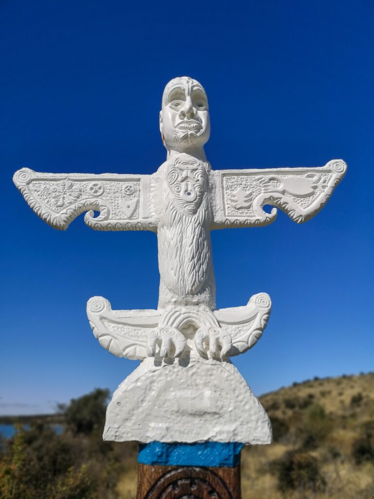
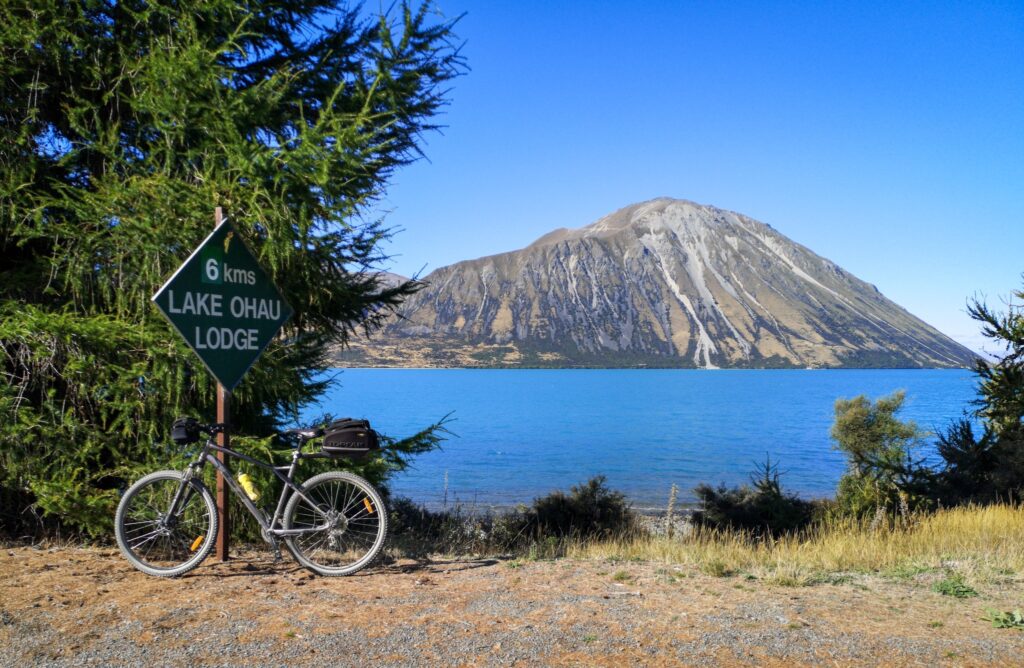
The ride lasted for 92 km and we finally arrived at Lake Ohau Lodge, where we had booked a room with both dinner and breakfast. Luxury!!
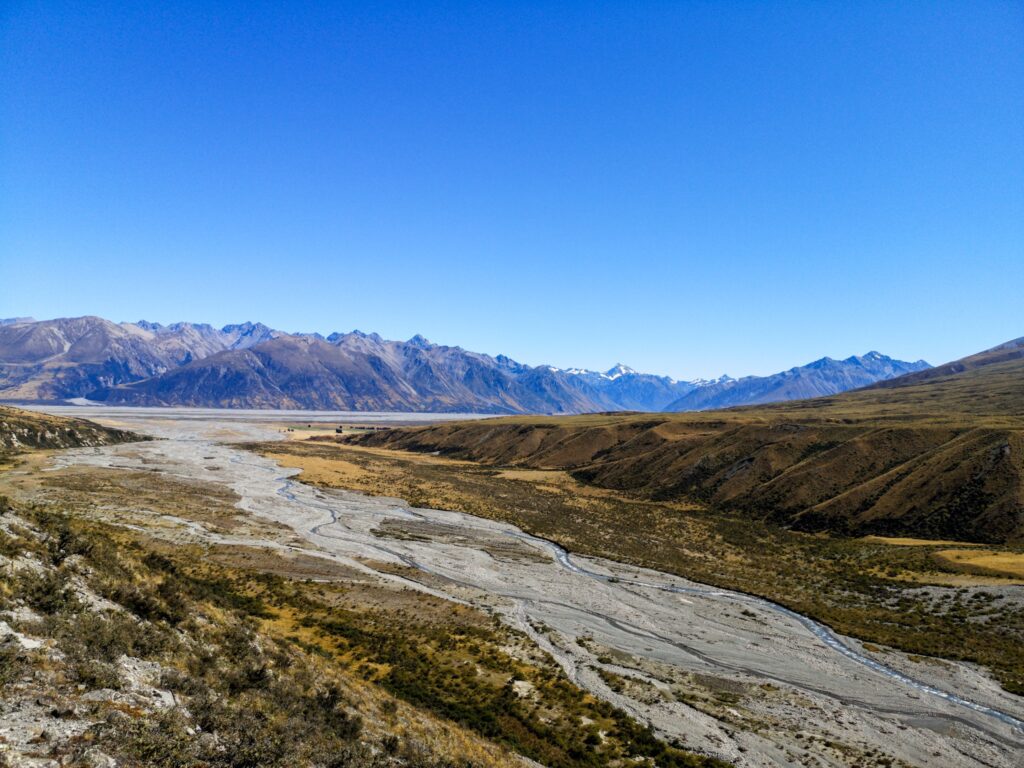
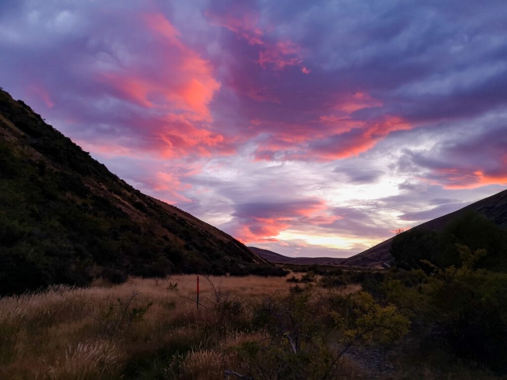
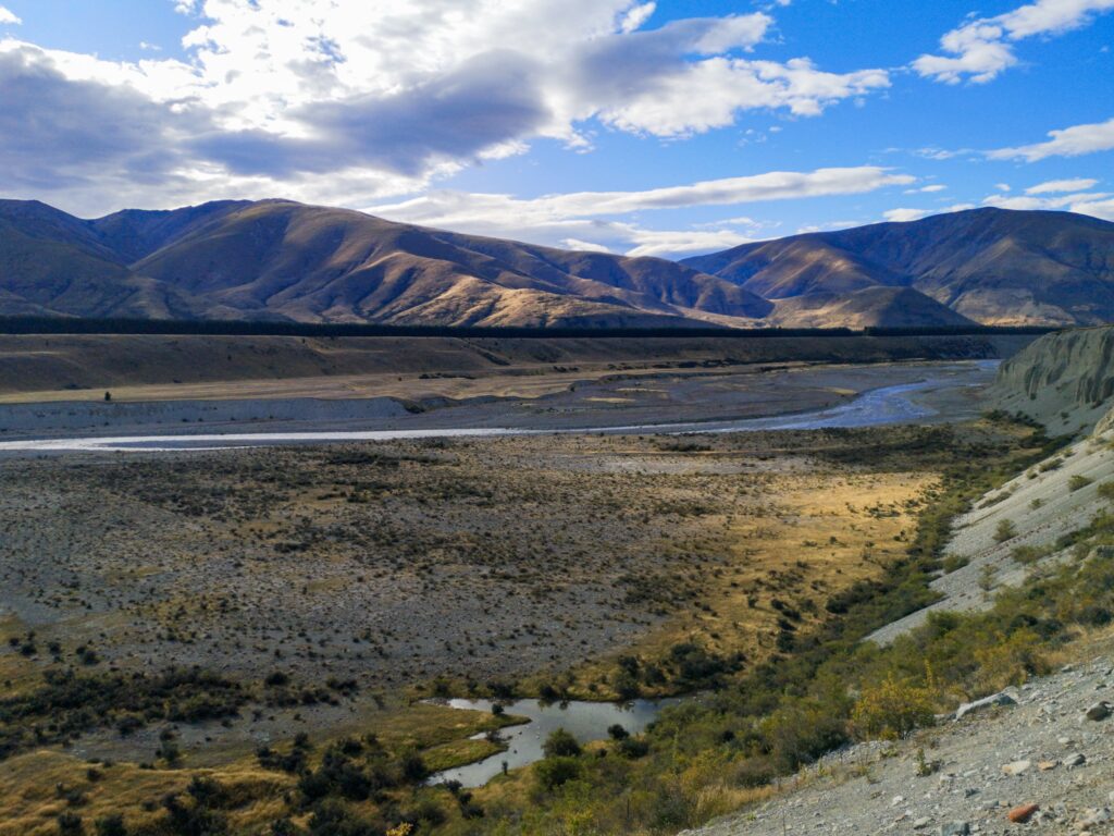
The next day it was time to start walking again, a long hike along river beds and up and down hills until just before the Ahuriri River. We camped close to a small stream and enjoyed a beautiful sunset and a cold windy night.
The next day started with a short walk to the Ahuriri River, a river crossing that is supposed to be the widest crossing on the TA, but it proved quite easy when we were there and it felt good to have it done.
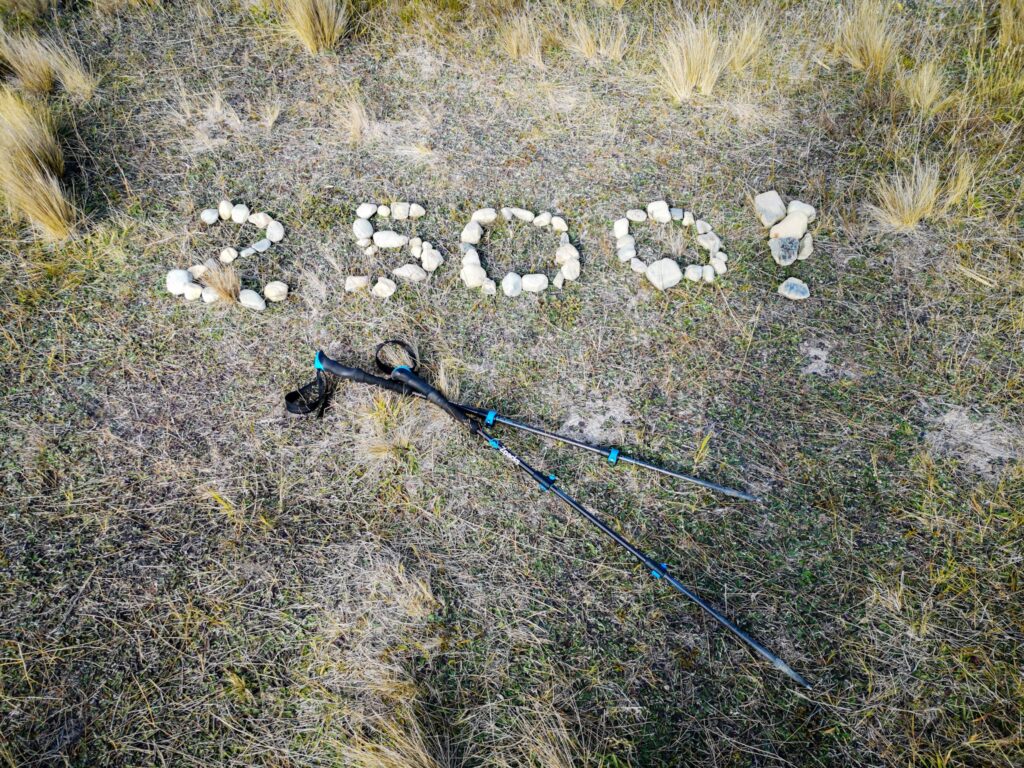
Shortly after the river crossing, we found the marker for 2500 km on the TA. Naturally, it did not mean that far for me as I’m only doing the South Island, but it did mean that I only had just over 500 km to go.
The day continued with a climb up towards Martha Saddle and the wind kept getting stronger and stronger. When I finally arrived at the saddle, it was blowing a gale and it took me 15 minutes just to try to get my rain jacket on. There were several times I was blown sideways and backwards but, luckily, the trail was both wide and well-formed.
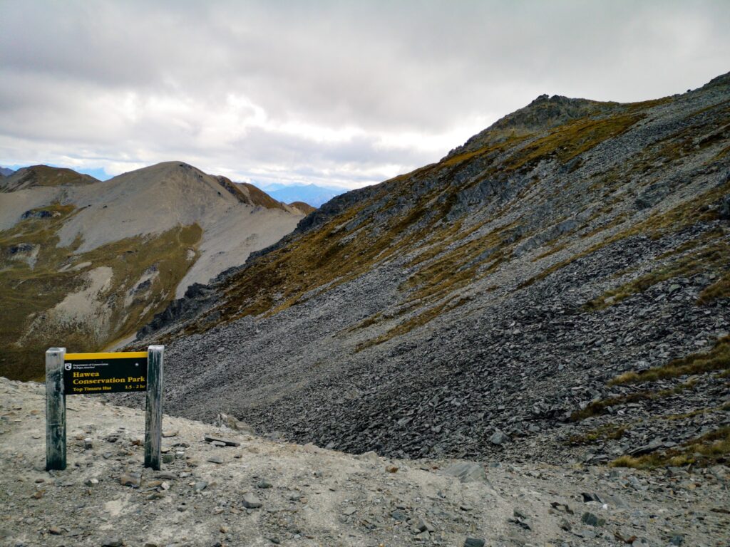
The day ended at Top Timaru Hut where we found two other couples that we had met earlier on the trail. It’s interesting the way through hiking becomes such a social event. Southbound hikers all become part of the same social group and you run into each other time and time again.

I expected the next day to be an easy day, but it proved hard and after only 14 km it was time to call it a day at Stodys Hut. The last 2 km were more or less straight up and were extremely taxing…
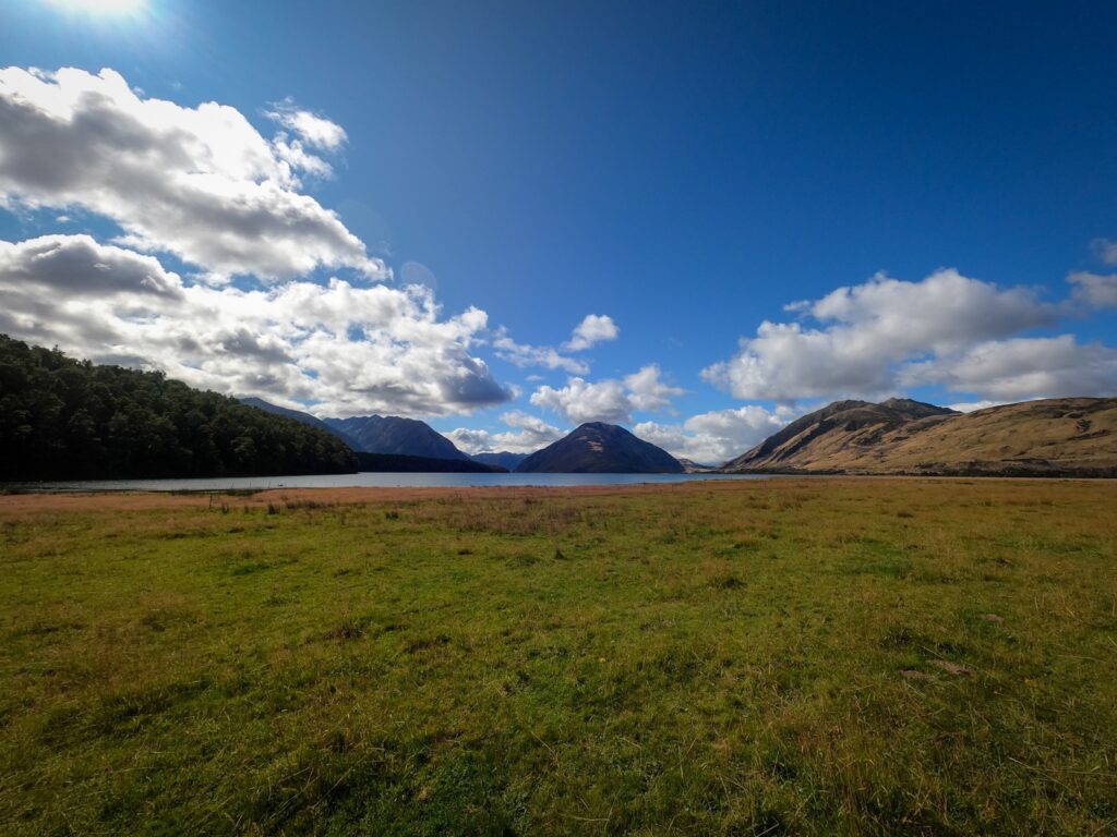
From Stodys, the next day was windy, cold and wet, with only a few glimpses of the scenery. A shame as the view of Lake Hawea is supposed to be exceptional.
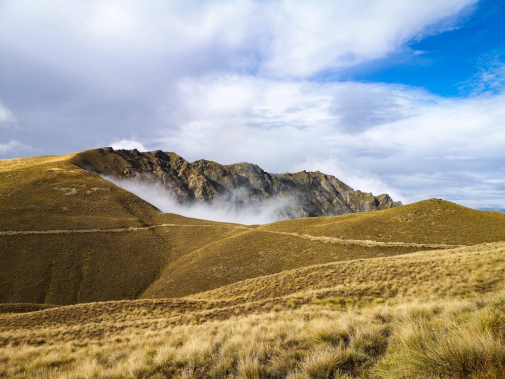
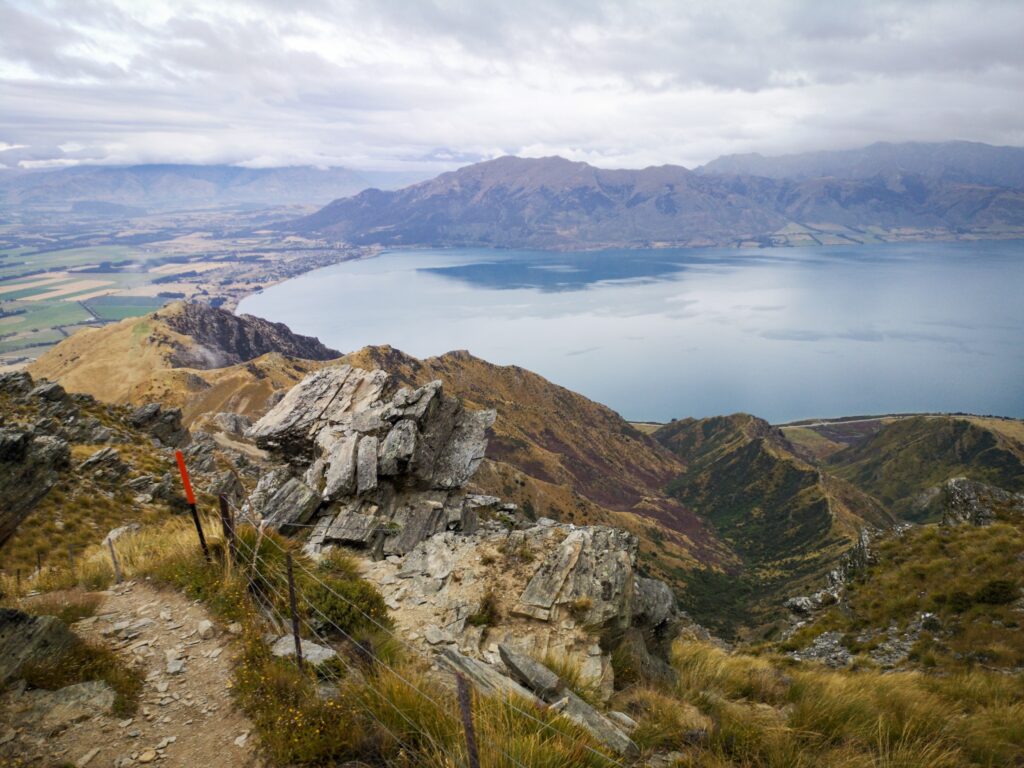
I did manage to get a little bit of a view from the ridge coming down towards Lake Hawea before the mist and rain closed in completely.
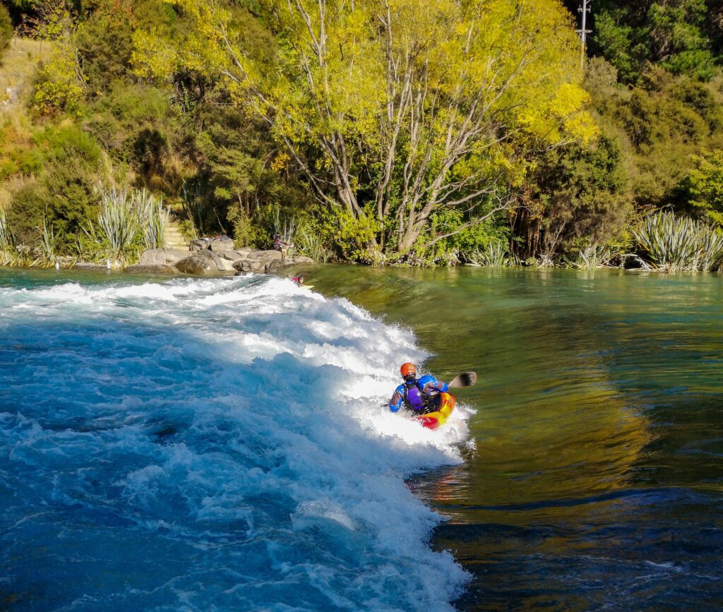
After a night in Lake Hawea, it was an easy, flat walk to Wanaka, mostly along roads and the side of the canal. Along the way, we were able to watch both surfers and kayakers practice on the standing waves generated at few places along the canal.
As I write this, we have had a rest day in Wanaka, done some resupplying and had what could possibly be the last beers and food in a restaurant for a while.
NZ is going into stage 4 virus alert and I am not quite sure how it is going to affect our chances of continuing. Restaurants, bars and takeaway places are closing and everyone is being told to stay at home. As my home is my tent at the moment, I am not sure what we will have to do. We have decided to continue to Queenstown tomorrow, as we will be very isolated while out on the trail, but DOC is closing huts and campgrounds so we might have a bit of trouble after that. We’ll have to make a new decision once, or if, we manage to reach Queenstown…
There are a lot of questions at the moment and I have no idea what is going to happen in the next week or so.
I have applied for an extension to my visa, at a cost of 256 dollars, and hope I will be able to stay in NZ for the next 4 months as my exit flight is to Australia and they have closed the borders completely.
For now, I’ll just keep walking…
Stuck in Christchurch… (2020-03-24 22:03)
Well, things change rapidly at the moment.
I did think that I was on my way “home”, but most countries are closing their borders even for transit travel and now I can’t use the tickets I managed to get a hold off just 2 days ago. Just hope I get a refund…
Since the last post, it’s been a bit of an emotional roller coaster. First trying to get supplies and get out on the trail, then finding out that the trail was closing and a 4-week self-isolation recommendation was coming into force. Trying to find a ticket home and finally getting one at the last moment and trying to come to terms with the fact that my journey was coming to an end…
Getting what seemed to have been the last bus to Christchurch and then, while on the bus, finding out that both Australia and Singapore were closing their airports and not allowing transit passengers.
That came just as I was starting to get resigned to the fact that I was returning to Stockholm and had started planning all the things I could get done there. There are a lot…
At the moment I am chasing a refund for the tickets I can’t use and Robert and I are looking for long term accommodation. It seems likely that we will be able to share an Airbnb with some other hikers, at least for a week or so.
But everything in Christchurch is closed, apart from the supermarkets and pharmacies, so we are going to have a lot of time to spend reading and surfing the net.
Maybe, just maybe, I will finally find the time and motivation to get some of the writing I am always thinking about done.
I’ll keep walking, if only around the block, just to keep my fitness up and it’s going to be very interesting to see how the situation continues to develop.
It’s long past due for an update here on the blog. I’ve been back in Stockholm for 2 months now and have just not really felt like writing anything. Mainly because there has not been much happening that relates to travel or walking. That does not mean that there hasn’t been a lot going on, but it’s been mostly stuff revolving around me trying to work out how I would be able to go travelling again once the corona epidemic finally gets under control.
I did finally manage to get a ticket “home” that I could use and while it was sad to leave everyone from Stuck Hut, they were all on their way back home as well.
I won’t write more today, I just wanted to update you with where I am and that I’m well and already planning many future adventures…